San Carlos
San Carlos kan avse:
- Teatro di San Carlo – operahuset i Neapel
Universitet
- University of San Carlos – i Cebu, Filippinerna
- Universidad de San Carlos de Guatemala – baserad i Guatemala City
Geografi
Argentina
- San Carlos, Corrientes, 27°44′45″S 55°53′50″V / 27.74586°S 55.89731°V
- San Carlos (kommun), Mendoza, 34°S 69°V / 34°S 69°V
- San Carlos (kommun), Salta, 25°45′00″S 66°05′00″V / 25.75°S 66.08333°V
- San Carlos, Mendoza, 33°46′09″S 69°02′40″V / 33.76928°S 69.04446°V
- San Carlos, Córdoba (Argentina), 31°10′39″S 65°06′09″V / 31.17761°S 65.10245°V
- San Carlos, Salta, 25°53′10″S 65°55′46″V / 25.88618°S 65.92941°V
- San Carlos de Bariloche
Bolivia
- San Carlos, Bolivia, 17°24′S 63°45′V / 17.4°S 63.75°V
Chile
- San Carlos (kommun i Chile), 36°23′08″S 72°01′07″V / 36.38558°S 72.0186°V
- San Carlos (ort i Chile, Región del Biobío, Provincia de Ñuble, lat -36,42, long -71,96), 36°25′29″S 71°57′29″V / 36.42477°S 71.958°V
Colombia
- San Carlos (kommun i Colombia, Córdoba, lat 8,70, long -75,70), 8°42′N 75°42′V / 8.7°N 75.7°V
- San Carlos, Córdoba (Colombia), 8°47′45″N 75°41′58″V / 8.79577°N 75.69947°V
- San Carlos (ort i Colombia, Antioquia, lat 7,79, long -74,77), 7°47′30″N 74°46′23″V / 7.79177°N 74.77316°V
- San Carlos (kommun i Colombia, Antioquia, lat 6,20, long -74,92), 6°12′00″N 74°55′00″V / 6.2°N 74.91667°V
- San Carlos (ort i Colombia, Antioquia, lat 6,19, long -74,99), 6°11′16″N 74°59′35″V / 6.18789°N 74.99315°V
- San Carlos (samhälle), Córdoba, 8°44′37″N 75°42′48″V / 8.74372°N 75.71331°V
Dominikanska republiken
- San Carlos (del av en befolkad plats), Santo Domingo, 18°29′00″N 69°54′00″V / 18.48333°N 69.9°V
Ekvatorialguinea
- Luba (provinshuvudstad), Provincia de Bioko Sur, 3°27′25″N 8°33′17″Ö / 3.45683°N 8.55465°Ö
Falklandsöarna
Filippinerna
- San Carlos City, Pangasinan, provins, Ilocosregionen, 15°55′00″N 120°20′00″Ö / 15.91667°N 120.33333°Ö
- San Carlos City, Negros Occidental, Province of Negros Occidental, 10°29′02″N 123°25′13″Ö / 10.484°N 123.4203°Ö
Guatemala
- San Carlos Sija, kommunhuvudort, Departamento de Quetzaltenango, Municipio de San Carlos Sija, 14°59′00″N 91°33′00″V / 14.98333°N 91.55°V
Mexiko
- Ursulo Galván, Veracruz, 19°24′16″N 96°21′35″V / 19.40446°N 96.35959°V
- San Carlos, Hidalgotitlán, 17°40′52″N 94°42′24″V / 17.68111°N 94.70667°V
- San Carlos, Tenosique, 17°25′50″N 91°29′30″V / 17.43045°N 91.49164°V
- San Carlos, Quintana Roo, José María Morelos, 19°38′02″N 88°56′21″V / 19.63386°N 88.93908°V
- San Carlos, Pinos, 22°20′59″N 101°28′54″V / 22.34984°N 101.48153°V
- Puerto San Carlos, Mexiko, ort, Baja California Sur, Comondú, 24°47′19″N 112°06′18″V / 24.78874°N 112.10504°V
- San Carlos (kommun i Mexiko, Tamaulipas, lat 24,40, long -98,99), 24°24′10″N 98°59′20″V / 24.40291°N 98.98898°V
- San Carlos, Álamo Temapache, 20°58′47″N 97°49′50″V / 20.97972°N 97.83056°V
- San Carlos, Baja California, Ensenada, 31°45′33″N 116°32′18″V / 31.75917°N 116.53833°V
- San Carlos, Zacapoaxtla, 19°54′26″N 97°36′06″V / 19.90712°N 97.60172°V
- San Carlos, Hueytamalco, 19°58′11″N 97°20′45″V / 19.96982°N 97.3458°V
- San Carlos, Balleza, 26°32′15″N 106°43′43″V / 26.5375°N 106.72861°V
- San Carlos, Tapachula, 15°02′17″N 92°15′25″V / 15.03806°N 92.25694°V
- San Carlos, Zozocolco de Hidalgo, 20°07′53″N 97°30′57″V / 20.13139°N 97.51583°V
- San Carlos, Pichucalco, 17°27′20″N 93°12′13″V / 17.45556°N 93.20361°V
Nicaragua
- San Carlos, Nicaragua, ort och kommun, 11°07′25″N 84°46′41″V / 11.1236°N 84.77795°V
Uruguay
- San Carlos, Uruguay, ort, Maldonado, 34°47′28″S 54°55′06″V / 34.79123°S 54.91824°V
USA
- San Carlos, Kalifornien, ort, San Mateo County, 37°30′26″N 122°15′38″V / 37.50716°N 122.26052°V
Se även
- San Carlos Park, Florida
Se även
- San Carlo
- San Carlos River
Media som används på denna webbplats
Författare/Upphovsman: NordNordWest, Licens: CC BY-SA 3.0
Location map of Argentina
Shiny blue button/marker widget.
Logo for disambiguation pages.
Författare/Upphovsman:
- Guatemala Departments.svg: Daryona
- Mexico location map.svg: NordNordWest
- härlett verk: Spischot
Location map of Guatemala
Författare/Upphovsman: TUBS
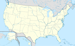
Location map of the USA (Hawaii and Alaska shown in sidemaps).
Main map: EquiDistantConicProjection : Central parallel :
* N: 37.0° N
Central meridian :
* E: 96.0° W
Standard parallels:
* 1: 32.0° N
* 2: 42.0° N
Made with Natural Earth. Free vector and raster map data @ naturalearthdata.com.
Formulas for x and y:
x = 50.0 + 124.03149777329222 * ((1.9694462586094064-({{{2}}}* pi / 180))
      * sin(0.6010514667026994 * ({{{3}}} + 96) * pi / 180))
y = 50.0 + 1.6155950752393982 * 124.03149777329222 * 0.02613325650382181
      - 1.6155950752393982  * 124.03149777329222 *
     (1.3236744353715044  - (1.9694462586094064-({{{2}}}* pi / 180))
      * cos(0.6010514667026994 * ({{{3}}} + 96) * pi / 180))
Hawaii side map: Equirectangular projection, N/S stretching 107 %. Geographic limits of the map:
- N: 22.4° N
- S: 18.7° N
- W: 160.7° W
- E: 154.6° W
Alaska side map: Equirectangular projection, N/S stretching 210.0 %. Geographic limits of the map:
- N: 72.0° N
- S: 51.0° N
- W: 172.0° E
- E: 129.0° W
Författare/Upphovsman: NordNordWest, Licens: CC BY-SA 3.0
Location map of Chile
Författare/Upphovsman: Sémhur, Licens: CC BY-SA 4.0
Map of Mexico, with states borders.
Författare/Upphovsman: NordNordWest, Licens: CC BY 3.0
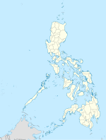
Location map of the Philippines
Författare/Upphovsman: Alexrk2, Licens: CC BY-SA 3.0
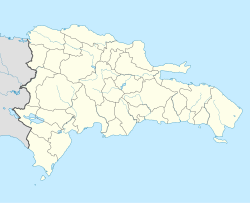
Location map Dominican Republic with Provinces, Equirectangular projection, N/S stretching 105 %. Geographic limits of the map:
Författare/Upphovsman: NordNordWest, Licens: CC BY-SA 3.0
Location map of Bolivia
(c) Karte: NordNordWest, Lizenz: Creative Commons by-sa-3.0 de
Location map of Equatorial Guinea
Författare/Upphovsman: Alexrk2, Licens: CC BY-SA 3.0
Location map of Nicaragua with Departamentos, Equirectangular projection, N/S stretching 100 %. Geographic limits of the map:
Författare/Upphovsman:
- Argentina_location_map.svg: NordNordWest
- Uruguay_departments_blank.svg: NielsF|talk/overleg/discussion/discussione 22:08, 23 November 2006 (UTC)
- derivative work: Spischot (talk)
Location map of Uruguay


