Samal (olika betydelser)
Samal kan syfta på följande platser:
Filippinerna
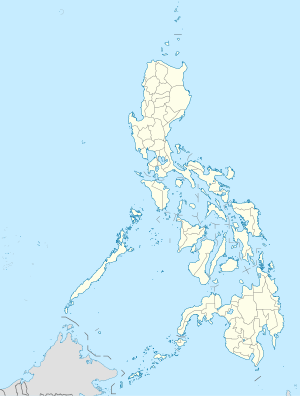
Samal i Filippinerna. |
- Samal River, vattendrag, Centrala Luzon, Province of Bataan, 14°46′02″N 120°32′23″Ö / 14.76722°N 120.53965°Ö
- Samal (kommunhuvudort i Filippinerna, Centrala Luzon, Province of Bataan, lat 14,77, long 120,54), 14°46′04″N 120°32′35″Ö / 14.76778°N 120.54306°Ö
- Samal, ort, Province of Davao del Norte, 7°04′28″N 125°42′30″Ö / 7.07444°N 125.70833°Ö
- Samal (kommun), Centrala Luzon, Province of Bataan, 14°46′00″N 120°29′00″Ö / 14.76667°N 120.48333°Ö
- Island Garden City of Samal, kommun, Davaoregionen, Province of Davao del Norte, 7°05′00″N 125°45′00″Ö / 7.08333°N 125.75°Ö
Iran
Samal i Iran. |
- Sarmal, ort, Bushehr, 29°06′50″N 51°04′03″Ö / 29.114°N 51.0674°Ö
- Samal-e Shomālī, ort, Bushehr, 29°06′24″N 51°13′35″Ö / 29.1066°N 51.2263°Ö
| Det här är en förgreningssida som listar artiklar associerade med titeln Samal. Om du kom hit via en wikilänk, får du gärna ändra länken så att den hänvisar direkt till den avsedda sidan. |
Media som används på denna webbplats
Shiny blue button/marker widget.
(c) Baumst, CC BY-SA 3.0
Disambiguation icon – gray scale version (author: Stephan Baum).
Författare/Upphovsman: NordNordWest, Licens: CC BY 3.0
Location map of the Philippines
Författare/Upphovsman: Uwe Dedering, Licens: CC BY-SA 3.0
Location map of Iran.
Equirectangular projection. Stretched by 118.0%. Geographic limits of the map:
* N: 40.0° N
* S: 24.5° N
* W: 43.5° E
* E: 64.0° E
Made with Natural Earth. Free vector and raster map data @ naturalearthdata.com.


