Salem, South Dakota
| Salem | |
| city | |
| Land | |
|---|---|
| Delstat | South Dakota |
| County | McCook County |
| Höjdläge | 464 m ö.h. |
| Koordinater | 43°43′27″N 97°23′20″V / 43.72417°N 97.38889°V |
| Yta | 3,2 km² (2010) |
| - land | 3,2 km² |
| - vatten | 0,0 km² |
| Folkmängd | 1 347 (2010) |
| Befolkningstäthet | 421 invånare/km² |
| Tidszon | CST (UTC-6) |
| - sommartid | CDT (UTC-5) |
| ZIP-kod | 57058 |
| Riktnummer | 605 |
| FIPS | 4657340 |
| Geonames | 5231228 |
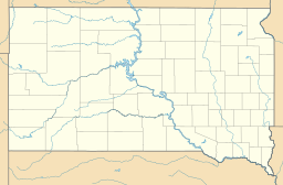
Ortens läge i South Dakota | |
South Dakotas läge i USA | |
| Webbplats: http://www.salemsd.com/ | |
Salem är administrativ huvudort i McCook County i South Dakota.[1] Orten har också hetat Melas för att undvika förväxling med en tidigare ort som hette Salena.[2] Enligt 2010 års folkräkning hade orten 1 347 invånare.[3]
Källor
- ^ South Dakota County Map with County Seat Cities. Geology.com Geoscience News and Information. Läst 30 november 2016.
- ^ Salem, SD. Map Quest. Läst 30 november 2016.
- ^ 2010 Census Population of Salem, South Dakota Arkiverad 30 november 2016 hämtat från the Wayback Machine.. Census Viewer. Läst 30 november 2016.
Media som används på denna webbplats
Shiny red button/marker widget. Used to mark the location of something such as a tourist attraction.
Författare/Upphovsman: Huebi, Licens: CC BY 2.0
Map of USA with South Dakota highlighted
Författare/Upphovsman: Alexrk, Licens: CC BY 3.0
Location map of South Dakota, USA


