Saint Louis (olika betydelser)
Saint Louis, Saint-Louis eller St. Louis kan avse:
- Saint Louis – en stad i den amerikanska delstaten Missouri
- Saint Louis – franskt och engelskt namn för en kung av Frankrike 1226–1270, se Ludvig IX av Frankrike
- Saint Louis – klassisk holländsk flodbåt
- Saint Louis (1626) – en galeon i franska flottan
- M/S St. Louis – en tysk oceanångare
- Ordre royal et militaire de Saint-Louis – en fransk riddarorden, se Sankt Ludvigsorden
Personer
- Fabienne St Louis (1988–), en mauritisk/fransk triathlet
- Louis St. Louis, amerikansk låtskrivare
- Martin St. Louis (1975–), kanadensisk ishockeyspelare
Katolska helgon
- Saint Louis – franskt och engelskt namn för en kung av Frankrike 1226–1270, se Ludvig IX av Frankrike
- Sankt Louis – en fransk präst i katolska kyrkan, se Louis-Marie Grignion de Montfort
Sport
Nuvarande lag baserade i Saint Louis, Missouri
- St. Louis Blues (ishockeyklubb) – ett professionellt ishockeylag i National Hockey League
- St. Louis Cardinals – ett professionellt basebollag i Major League Baseball
- St. Louis Rams – ett professionellt amerikanskt fotbollslag i National Football League
Lag som tidigare var baserade i Saint Louis, Missouri
- Arizona Cardinals – ett professionellt amerikanskt fotbollslag , formerly the St. Louis Cardinals (1960–1987)
- St. Louis Browns – ett professionellt basebollag som 1954 blev Baltimore Orioles
Geografi
Antarktis
Frankrike
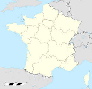
- Saint-Louis-lès-Bitche, kommun, Lorraine, Département de la Moselle, 48°59′13″N 7°21′22″Ö / 48.987°N 7.35602°Ö
- Saint-Louis-de-Montferrand, kommun, Aquitaine, Département de la Gironde, 44°57′00″N 0°32′08″V / 44.95°N 0.53543°V
- Saint-Louis, Haut-Rhin, kommun, 47°35′07″N 7°33′54″Ö / 47.58528°N 7.565°Ö
- Saint-Louis, Moselle, kommun, 48°43′01″N 7°11′20″Ö / 48.7169°N 7.1889°Ö
- Saint-Louis-en-l'Isle, Dordogne, 45°03′41″N 0°23′32″Ö / 45.0614°N 0.3922°Ö
- Saint-Louis-et-Parahou, Aude, 42°50′54″N 2°19′11″Ö / 42.8483°N 2.3197°Ö
- Île Saint-Louis, en ö i floden Seine i Paris, 48°51′07″N 2°21′24″Ö / 48.8519°N 2.3567°Ö
- Port-Saint-Louis-du-Rhône, kommun, Bouches-du-Rhône, 43°23′15″N 4°48′01″Ö / 43.3875°N 4.8004°Ö
Grenada
Guadeloupe
- Saint-Louis (kommun i Guadeloupe), 15°57′N 61°18′V / 15.95°N 61.3°V
Haiti
Saint-Louis du Nord i Haiti. |
- Arrondissement de Saint-Louis du Nord, arrondissement, Nord-Ouest, 19°51′00″N 72°40′00″V / 19.85°N 72.66667°V
- Saint-Louis du Nord (kommun), Nord-Ouest, 19°51′N 72°42′V / 19.85°N 72.7°V
- Saint-Louis du Sud (kommun), 18°18′00″N 73°31′00″V / 18.3°N 73.51667°V
Kanada
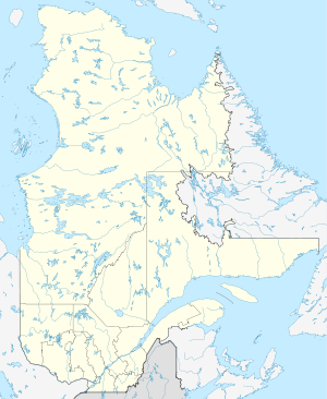
- Saint-Louis, Québec, kommun i Montérégie, 45°51′00″N 72°58′57″V / 45.85007°N 72.98244°V
- Saint-Louis-de-Gonzague, Montérégie, kommun i Québec, 45°12′00″N 73°58′57″V / 45.20008°N 73.98252°V
- Saint-Louis-de-Gonzague, Chaudière-Appalaches, kommun i Québec, 46°16′08″N 70°19′39″V / 46.26879°N 70.3275°V
- Saint-Louis-de-Blandford – en kommun i provinsen Québec
- Saint-Louis-de-France – en tidigare kommun i regionen Mauricie och provinsen Québec (slogs samman till Trois-Rivières 2002)
- Saint-Louis-de-Gonzague-du-Cap-Tourmente – en kommun i regionen Capitale-Nationale och provinsen Québec
- Saint-Louis-du-Ha! Ha! – en kommun i Québec
Senegal
- Saint-Louis (region), region, 16°20′00″N 15°00′00″V / 16.33333°N 15°V
- Saint-Louis, Senegal, regionhuvudort, 16°01′05″N 16°29′23″V / 16.01793°N 16.48962°V
- Saint-Louis Airport, flygplats, 16°03′03″N 16°27′47″V / 16.05076°N 16.46317°V
Seychellerna
- Saint Louis, Seychellerna – ett av Seychellernas 26 distrikt
USA
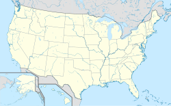
- Saint Louis – Missouri, City of Saint Louis, 38°37′38″N 90°11′52″V / 38.62727°N 90.19789°V
- St. Louis County, Missouri – ett administrativt område i delstaten Missouri (inte staden Saint Louis, Missouri)
- St. Louis Park, Minnesota
- Bay St. Louis, Mississippi
- East St. Louis, Illinois
Universitet
- Saint Louis University (SLU), Saint Louis, Missouri
- Saint Louis Billikens, skolans atletiska program
- University of Missouri–St. Louis (UMSL)
- Washington University in St. Louis (WUSTL)
Se även
- Saint Louis County – flera
Militär
- Saint Louis (1626) – galeon i franska flottan, sjösatt 1626.
Se även
- San Luis, det spanska språkets besläktnad med namnet
- São Luís (olika betydelser), det portugisiska språkets besläktnad med namnet
- Spirit of St. Louis (olika betydelser) – flera
Media som används på denna webbplats
Författare/Upphovsman: Alexrk2, Licens: CC BY-SA 3.0
Location map Antarctica, Azimuthal equidistant projection
Shiny blue button/marker widget.
Författare/Upphovsman: TUBS
Location map of the USA (Hawaii and Alaska shown in sidemaps).
Main map: EquiDistantConicProjection : Central parallel :
* N: 37.0° N
Central meridian :
* E: 96.0° W
Standard parallels:
* 1: 32.0° N
* 2: 42.0° N
Made with Natural Earth. Free vector and raster map data @ naturalearthdata.com.
Formulas for x and y:
x = 50.0 + 124.03149777329222 * ((1.9694462586094064-({{{2}}}* pi / 180))
      * sin(0.6010514667026994 * ({{{3}}} + 96) * pi / 180))
y = 50.0 + 1.6155950752393982 * 124.03149777329222 * 0.02613325650382181
      - 1.6155950752393982  * 124.03149777329222 *
     (1.3236744353715044  - (1.9694462586094064-({{{2}}}* pi / 180))
      * cos(0.6010514667026994 * ({{{3}}} + 96) * pi / 180))
Hawaii side map: Equirectangular projection, N/S stretching 107 %. Geographic limits of the map:
- N: 22.4° N
- S: 18.7° N
- W: 160.7° W
- E: 154.6° W
Alaska side map: Equirectangular projection, N/S stretching 210.0 %. Geographic limits of the map:
- N: 72.0° N
- S: 51.0° N
- W: 172.0° E
- E: 129.0° W
Logo for disambiguation pages.
Författare/Upphovsman: NordNordWest, Licens: CC BY-SA 3.0
Location map of Seychelles
Författare/Upphovsman: Alexrk2, Licens: CC BY-SA 3.0
Location map Haiti with departements, Equirectangular projection, N/S stretching 105 %. Geographic limits of the map:
Författare/Upphovsman: NordNordWest, Licens: CC BY-SA 3.0
Location map of Senegal
Författare/Upphovsman: Eric Gaba (Sting - fr:Sting), Licens: CC BY-SA 3.0
Blank administrative map of the region and department of Guadeloupe, France, for geo-location purpose, with arrondissements boundaries.
Författare/Upphovsman: NordNordWest, Licens: CC BY-SA 3.0
Location map of Quebec, Canada
Författare/Upphovsman: Superbenjamin, Licens: CC BY-SA 4.0
Blank administrative map of France for geo-location purpose, with regions. Approximate scale : 1:3,000,000


