Saint Barthélemy
Saint-Barthélemy eller Saint Barthélemy, som är det franska namnet på aposteln sankt Bartolomaios, kan avse:
- Svenska Sankt Barthélemy – en svensk koloni som grundades 1784 på ön Saint-Barthélemy
- Saint Barthélemy – en så kallad bermudajakt i svenska flottan
- Bartolomeinatten eller Massacre de la Saint-Barthélemy (1572)
- St Bartholomew's Hospital – ett sjukhus i City of London
- Kaiserdom St. Bartholomäus – en medeltida hallkyrka i centrala Frankfurt am Main
Geografi
Frankrike
- Saint-Barthélemy-le-Plain, ort och kommun, departementet Ardèche i regionen Auvergne-Rhône-Alpes, 45°03′16″N 4°44′49″Ö / 45.05446°N 4.74704°Ö
- Saint-Barthélemy-le-Meil, ort och kommun, departementet Ardèche i regionen Auvergne-Rhône-Alpes, 44°53′05″N 4°29′53″Ö / 44.8848°N 4.49818°Ö
- Saint-Barthélemy-de-Vals, ort och kommun, departementet Drôme i regionen Auvergne-Rhône-Alpes, 45°10′02″N 4°52′11″Ö / 45.16729°N 4.86977°Ö
- Saint-Barthélemy-de-Bellegarde, ort och kommun, departementet Dordogne i regionen Nouvelle-Aquitaine, 45°04′00″N 0°12′00″Ö / 45.06667°N 0.2°Ö
- Saint-Barthélemy, Seine-et-Marne, ort och kommun, 48°48′59″N 3°21′36″Ö / 48.81639°N 3.36°Ö
- Saint-Barthélemy, Manche, ort och kommun, 48°40′53″N 0°57′10″V / 48.68139°N 0.95278°V
- Saint-Barthélemy, Haute-Saône, ort och kommun, 47°44′57″N 6°35′17″Ö / 47.74917°N 6.58806°Ö
- Saint-Barthélemy, Isère, ort och kommun, 45°20′47″N 5°04′49″Ö / 45.3465°N 5.0804°Ö
- Saint-Barthélemy, Landes, ort och kommun, 43°30′52″N 1°19′53″V / 43.51444°N 1.33139°V
- Saint-Barthélemy, Morbihan, ort och kommun, Bretagne, 47°55′33″N 3°02′43″V / 47.92583°N 3.04528°V
- Saint-Barthélemy-d'Agenais, ort och kommun, Aquitaine, Lot-et-Garonne, 44°31′N 0°22′Ö / 44.52°N 0.37°Ö
- Saint-Barthélemy-d'Anjou, ort och kommun, Pays de la Loire, Maine-et-Loire, 47°28′N 0°30′V / 47.47°N 0.5°V
- Saint-Barthélemy-de-Bussière, ort och kommun, Aquitaine, Dordogne, 45°39′N 0°45′Ö / 45.65°N 0.75°Ö
- Saint-Barthélemy-de-Séchilienne, ort och kommun, Rhône-Alpes, Isère, 45°02′N 5°49′Ö / 45.04°N 5.81°Ö
- Saint-Barthélemy-Grozon, ort och kommun, departementet Ardèche i regionen Auvergne-Rhône-Alpes, 44°58′N 4°38′Ö / 44.96°N 4.63°Ö
- Saint-Barthélemy-Lestra, ort och kommun, Rhône-Alpes, Loire, 45°43′N 4°20′Ö / 45.72°N 4.34°Ö
- Montigny-Saint-Barthélemy, ort och kommun, Bourgogne, Côte-d'Or, 47°25′N 4°16′Ö / 47.42°N 4.27°Ö
Kanada
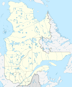
- Saint-Barthélemy, Québec, kommun i Lanaudière, 46°11′00″N 73°07′57″V / 46.18336°N 73.13244°V
Saint-Barthélemy
- Saint-Barthélemy, ö och utomeuropeiskt förvaltningsområde, före detta svensk koloni, 17°54′00″N 62°49′33″V / 17.9°N 62.8257°V
Schweiz
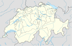
- Saint-Barthélemy, Vaud, ort och kommun, 46°38′05″N 6°36′08″Ö / 46.63484°N 6.60212°Ö
Media som används på denna webbplats
Shiny blue button/marker widget.
Logo for disambiguation pages.
Författare/Upphovsman: Superbenjamin, Licens: CC BY-SA 4.0
Blank administrative map of France for geo-location purpose, with regions and departements distinguished. Approximate scale : 1:3,000,000
Map of the Caribbean and Central America.
Bounding box West -93°, South 7°, East -58°, North 28°.
Center at 17°30′00″N 75°30′00″W / 17.50000°N 75.50000°W.Författare/Upphovsman: NordNordWest, Licens: CC BY-SA 3.0
Location map of Quebec, Canada
Författare/Upphovsman: NordNordWest, Licens: CC BY-SA 3.0
Location map of Switzerland


