Rudolph, Ohio
| Rudolph | |
| CDP | |
| Land | |
|---|---|
| Delstat | |
| County | Wood County |
| Höjdläge | 208 m ö.h. |
| Koordinater | 41°17′52″N 83°40′12″V / 41.29778°N 83.67000°V |
| Area | 2,12 km² (2010)[1][2] |
| Folkmängd | 415 (2020)[3] |
| Befolkningstäthet | 196 invånare/km² |
| Tidszon | EST (UTC-5) |
| - sommartid | EDT (UTC-4) |
| ZIP-kod | 43462 |
| Riktnummer | 419 |
| GNIS-kod | 2628965 |
| Geonames | 5168744 |
Översiktskarta | |
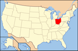
Ohios läge i USA | |
| Wikimedia Commons: Rudolph, Ohio | |
| Redigera Wikidata | |
Rudolph är en ort i Wood Country i delstaten Ohio, USA.
Referenser
- ^ United States Census Bureau, 2016 U.S. Gazetteer Files, United States Census Bureau, 2016.[källa från Wikidata]
- ^ United States Census Bureau, 2010 U.S. Gazetteer Files, United States Census Bureau, 2010, läst: 9 juli 2020.[källa från Wikidata]
- ^ United States Census Bureau (red.), USA:s folkräkning 2020, läs online, läst: 1 januari 2022.[källa från Wikidata]
Media som används på denna webbplats
Författare/Upphovsman: This version: uploader
Base versions this one is derived from: originally created by en:User:Wapcaplet, Licens: CC BY 2.0
Map of USA with Ohio highlighted
Locator map of the unincorporated community of Rudolph in Wood County, Ohio, United States.
Författare/Upphovsman: Photo by and ©2010 Dustin M. Ramsey (Kralizec!), Licens: CC BY-SA 2.5
Photograph of the unincorporated community of
Rudolph, Ohioen, taken at street level from Main Street, looking East toward the local office of the United States Postal Serviceen and Mermill Road.


