Rocky Ridge, Ohio
| Rocky Ridge | |
| village | |
| Land | |
|---|---|
| Delstat | Ohio |
| County | Ottawa County |
| Höjdläge | 185 m ö.h. |
| Koordinater | 41°32′0″N 83°12′45″V / 41.53333°N 83.21250°V |
| Yta | 2,63 km² (2010) |
| - land | 2,59 km² |
| - vatten | 0,04 km² |
| Folkmängd | 417 (2010) |
| Befolkningstäthet | 161 invånare/km² |
| Tidszon | EST (UTC-5) |
| - sommartid | EDT (UTC-4) |
| ZIP-kod | 43458 |
| Riktnummer | 419 |
| FIPS | 3968042 |
| Geonames | 5168488 |
Ortens läge i Ohio | |
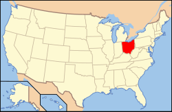
Ohios läge i USA | |
Rocky Ridge är en ort (village) i Ottawa County i Ohio.[1] Vid 2010 års folkräkning hade Rocky Ridge 417 invånare.[2]
Källor
- ^ Rocky Ridge, OH. Map Quest. Läst 25 oktober 2021.
- ^ Rocky Ridge, Ohio. Roadside Thoughts. Läst 25 oktober 2021.
|
Media som används på denna webbplats
Shiny red button/marker widget. Used to mark the location of something such as a tourist attraction.
Författare/Upphovsman: This version: uploader
Base versions this one is derived from: originally created by en:User:Wapcaplet, Licens: CC BY 2.0
Map of USA with Ohio highlighted
Front and western side of the former St. John's Lutheran Church, located at 14532 Second Street in Rocky Ridge, Ohio, United States. It was built in 1889, and the church's nearby current building was built in 1967.
Författare/Upphovsman: Alexrk2, Licens: CC BY 3.0
Den här Det karta skapades med GeoTools.


