Rocky Point
Rocky Point kan syfta på följande platser:
Antarktis
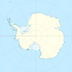
- Rocky Point (udde i Antarktis), 77°30′00″S 166°14′00″Ö / 77.5°S 166.23333°Ö
Jamaica
- Rocky Point, Jamaica, ort, 17°46′26″N 77°15′40″V / 17.774°N 77.26107°V
Sydgeorgien och Sydsandwichöarna
- Kanin Point, udde, 54°11′00″S 36°42′00″V / 54.18333°S 36.7°V
- Chinstrap Point, udde, 57°07′00″S 26°46′00″V / 57.11667°S 26.76667°V
- Carey Point (udde i Sydgeorgien och Sydsandwichöarna), 57°47′00″S 26°32′00″V / 57.78333°S 26.53333°V
USA
- Rocky Point (Massachusetts), udde, Plymouth County, 41°56′59″N 70°35′00″V / 41.949722°N 70.583333°V
- Rocky Point, New York, ort, Suffolk County, 40°57′09″N 72°55′31″V / 40.9526°N 72.92538°V
- Rocky Point, North Carolina, ort, Pender County, 34°26′07″N 77°53′16″V / 34.43517°N 77.88776°V
- Rocky Point, Montana, ort, Lake County, 47°44′06″N 114°10′46″V / 47.73494°N 114.17956°V
- Rocky Point, Washington, ort, Kitsap County, 47°35′34″N 122°40′07″V / 47.59287°N 122.66848°V
| Det här är en förgreningssida som listar artiklar associerade med titeln Rocky Point. Om du kom hit via en wikilänk, får du gärna ändra länken så att den hänvisar direkt till den avsedda sidan. |
Media som används på denna webbplats
Shiny blue button/marker widget.
(c) Baumst, CC BY-SA 3.0
Disambiguation icon – gray scale version (author: Stephan Baum).
Författare/Upphovsman: TUBS
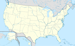
Location map of the USA (Hawaii and Alaska shown in sidemaps).
Main map: EquiDistantConicProjection : Central parallel :
* N: 37.0° N
Central meridian :
* E: 96.0° W
Standard parallels:
* 1: 32.0° N
* 2: 42.0° N
Made with Natural Earth. Free vector and raster map data @ naturalearthdata.com.
Formulas for x and y:
x = 50.0 + 124.03149777329222 * ((1.9694462586094064-({{{2}}}* pi / 180))
      * sin(0.6010514667026994 * ({{{3}}} + 96) * pi / 180))
y = 50.0 + 1.6155950752393982 * 124.03149777329222 * 0.02613325650382181
      - 1.6155950752393982  * 124.03149777329222 *
     (1.3236744353715044  - (1.9694462586094064-({{{2}}}* pi / 180))
      * cos(0.6010514667026994 * ({{{3}}} + 96) * pi / 180))
Hawaii side map: Equirectangular projection, N/S stretching 107 %. Geographic limits of the map:
- N: 22.4° N
- S: 18.7° N
- W: 160.7° W
- E: 154.6° W
Alaska side map: Equirectangular projection, N/S stretching 210.0 %. Geographic limits of the map:
- N: 72.0° N
- S: 51.0° N
- W: 172.0° E
- E: 129.0° W
Författare/Upphovsman: Alexrk2, Licens: CC BY-SA 3.0
Location map Antarctica, Azimuthal equidistant projection
Författare/Upphovsman: NordNordWest, Licens: CC BY-SA 3.0 de
Location map of Jamaica
Författare/Upphovsman: Dr. Blofeld, Licens: CC BY-SA 2.0
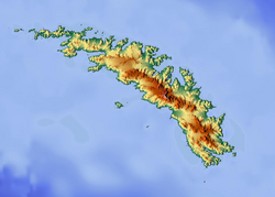
Map of South Georgia for pin
Geographic limits of the map:
- N: -53.809°
- S: -55.085°
- W: -38.4°
- E: -35.327°
- Du är fri:
- att dela – att kopiera, distribuera och sända verket
- att remixa – att skapa bearbetningar
- På följande villkor:
- erkännande – Du måste ge lämpligt erkännande, ange en länk till licensen och indikera om ändringar har gjorts. Du får göra det på ett lämpligt sätt, men inte på ett sätt som antyder att licensgivaren stödjer dig eller din användning.
- dela lika – Om du remixar, transformerar eller bygger vidare på materialet måste du distribuera dina bidrag under samma eller en kompatibel licens som originalet.


