Rockville, Maryland
| Den här artikeln behöver källhänvisningar för att kunna verifieras. (2023-11) Åtgärda genom att lägga till pålitliga källor (gärna som fotnoter). Uppgifter utan källhänvisning kan ifrågasättas och tas bort utan att det behöver diskuteras på diskussionssidan. |
| Rockville, Maryland | |
| Land | |
|---|---|
| Delstat | Maryland |
| Läge | 39°5′1″N 77°8′54″V / 39.08361°N 77.14833°V |
| Yta | |
| - total: | 34,8 km² |
| - varav land: | 34,8 km² |
| - varav vatten: | 0,0 km² |
| Folkmängd | 60 734 (2008) |
| Geonames | 4367175 7316547 |
Rockvilles läge i Montgomery County och countyts läge i Maryland | |
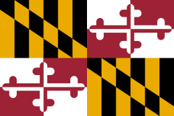
Rockville är en stad i Montgomery County i delstaten Maryland, USA med 60 734 invånare år 2008. Rockville är administrativ huvudort (county seat) i Montgomery County och ingår i Washingtons storstadsområde.
Externa länkar
| ||||||||||
Media som används på denna webbplats
Författare/Upphovsman: Tkgd2007, Licens: CC BY-SA 3.0
A new incarnation of Image:Question_book-3.svg, which was uploaded by user AzaToth. This file is available on the English version of Wikipedia under the filename en:Image:Question book-new.svg
Författare/Upphovsman: Arkyan, Licens: CC BY-SA 3.0
This map shows the incorporated and unincorporated areas in Montgomery County, Maryland, highlighting Rockville in red. It was created with a custom script with US Census Bureau data and modified with Inkscape.
The skyline of downtown Rockville, Maryland in 2001. This photograph was taken by David Podgor and has been released into the public domain by the author.


