Rockdale, Texas
| Rockdale, Texas | |
| Stad (city) | |
| Land | |
|---|---|
| Delstat | |
| County | Milam County |
| Höjdläge | 142 m ö.h. |
| Koordinater | 30°39′17″N 97°0′27″V / 30.65472°N 97.00750°V |
| Area | 10,74 km² (2010)[1] |
| Folkmängd | 5 323 (2020)[2] |
| Befolkningstäthet | 495 invånare/km² |
| Tidszon | CST (UTC-6) |
| - sommartid | CDT (UTC-5) |
| ZIP-kod | 76567 |
| Riktnummer | 512 |
| GNIS-kod | 1366723 |
| Geonames | 4723369 |
Översiktskarta | |
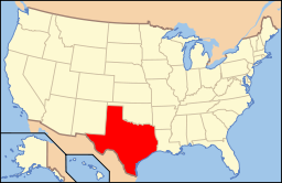
Texas läge i USA | |
| Wikimedia Commons: Rockdale, Texas | |
| Webbplats: http://www.rockdalecityhall.com/ | |
| Redigera Wikidata | |
Rockdale är en ort i Milam County i Texas.[3] Vid 2020 års folkräkning hade Rockdale 5 323 invånare.[4]
Källor
- ^ United States Census Bureau, 2010 U.S. Gazetteer Files, United States Census Bureau, 2010, läst: 9 juli 2020.[källa från Wikidata]
- ^ United States Census Bureau (red.), USA:s folkräkning 2020, läs online, läst: 1 januari 2022.[källa från Wikidata]
- ^ Rockdale, TX. Map Quest. Läst 4 september 2021.
- ^ ”Rockdale city, Texas 2020 Decennial Census” (på engelska). United States Census Bureau. https://data.census.gov/profile/Rockdale_city,_Texas?g=160XX00US4862672. Läst 8 april 2023.
Media som används på denna webbplats
Författare/Upphovsman: Billy Hathorn, Licens: CC BY 3.0
I took photo of Rockdale City Hall in Rockdale, TX, with Canon camera.
Författare/Upphovsman: The original uploader was Seth Ilys på engelska Wikipedia., Licens: CC BY-SA 3.0
Adapted from Wikipedia's TX county maps by Seth Ilys.
Författare/Upphovsman: This version: uploader
Base versions this one is derived from: originally created by en:User:Wapcaplet, Licens: CC BY 2.0
Map of USA with Texas highlighted


