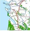
Rochefort, Charente-Maritime
| Rochefort | ||
| Kommun | ||
| ||
| Land | ||
|---|---|---|
| Region | Nouvelle-Aquitaine | |
| Departement | ||
| Arrondissement | Rochefort | |
| Kanton | chef-lieu över 3 kantoner | |
| Koordinater | 45°56′N 0°59′V / 45.933°N 0.983°V | |
| Yta | 21,95 km²[1] | |
| Folkmängd | 23 092 ()[2] | |
| Befolkningstäthet | 1 052 invånare/km² | |
| Postnummer | 17300 | |
| INSEE | 17299 | |
| Geonames | 2983276 | |
| OSM-karta | 117888 | |
 Kommunens läge i regionen Nouvelle-Aquitaine i Frankrike | ||
| Webbplats: http://www.ville-rochefort.fr | ||

Rochefort, inofficiellt också Rochefort-sur-Mer, är en stad i sydvästra Frankrike i departementet Charente-Maritime och regionen Nouvelle-Aquitaine.
Det är den tredje största staden i Charente-Maritime efter La Rochelle och Saintes.
Läge
Rochefort ligger 28 km söder om La Rochelle som är huvudstad i Charente-Maritime. Staden ligger också 6 km väster om Tonnay-Charente, 30 km norr om Royan och 40 km nordväst om Saintes, andra städer som ligger i Charente-Maritime.
Som Tonnay-Charente, ligger hela staden vid högra stranden av floden Charente. Staden ligger cirka 20 km från flodens mynning i Atlanten.
Det är både en hamnstad med flera industrier och en turisthamn med omkring tre hundra fritidsbåtar och segelbåtar.

Befolkning
Staden hade 25 999 invånare (2007) och är den tredje orten av Charente-Maritime efter La Rochelle och Saintes.
Rochefort med förorter har ungefär 40 000 invånare (2007).
Dess invånare kallas på franska Rochefortaises (f) och Rochefortais (m).
Befolkningsutveckling
Antalet invånare i kommunen Rochefort
 Referens: INSEE[3] |
En historisk stad
Den grundades 1666 för att fungera som flottbas.
En turistort
Rochefort är en viktig turistort med tio museer.
Finns det också en viktig kurort i Rochefort med 12 000 patienter varje år[4].
Se även
Källor
- ^ Répertoire géographique des communes, Institut national de l'information géographique et forestière, läst: 26 oktober 2015, licens: öppen licens.[källa från Wikidata]
- ^ Populations légales 2021, Institut National de la Statistique et des Études Économiques, 28 december 2023.[källa från Wikidata]
- ^ Chiffres clés - Évolution et structure de la population hämtat från the Wayback Machine (arkiverat 4 maj 2012).
- ^ Officiell webbsplats om Rocheforts kurort Arkiverad 28 januari 2011 hämtat från the Wayback Machine.
Externa länkar
- Officiell webbplats om Rochefort
 Wikimedia Commons har media som rör Rochefort.
Media som används på denna webbplats
Författare/Upphovsman: Eric Gaba (Sting - fr:Sting), Licens: CC BY-SA 4.0
Blank physical map of metropolitan France for geo-location purpose.
Scale : 1:14 816 000 (accuracy : about 3,7 km) for the bathymetry. More maps of France, view → Commons Atlas of France.
Shiny red button/marker widget. Used to mark the location of something such as a tourist attraction.
Författare/Upphovsman: IAAT, Licens: CC BY-SA 3.0
Carte du département Charente-Maritime
Légende :
Författare/Upphovsman: Michiel1972, Licens: CC BY-SA 3.0
Population - Municipality code 17299.svg
Population Census 1962-2008Författare/Upphovsman:
|
Map data (c) OpenStreetMap contributors, CC-BY-SA  • Shape files infrastructure: railway, highways, water: all originally by OpenStreetMap contributors. Status december 2011 *note: shown commune boundaries are from OSM dump May 2012; at that time about 90% complete |
Map commune FR insee code 17299.png
Författare/Upphovsman: unknown, Licens: CC BY-SA 3.0
Författare/Upphovsman: Myrabella, Licens: CC BY-SA 3.0
Rochefort (Charente-Maritime, France) - Rue de la République


