Richmond
Richmond kan syfta på
Geografi
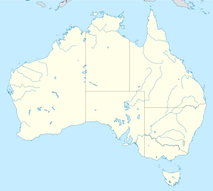
Australien
- Richmond, Tasmanien, ort, Clarence, 42°44′08″S 147°26′18″Ö / 42.73554°S 147.43833°Ö
- Richmond (del av en befolkad plats i Australien, Victoria), Yarra, 37°49′05″S 145°00′06″Ö / 37.81819°S 145.00176°Ö
- Richmond (ort i Australien, New South Wales), Hawkesbury, 33°35′58″S 150°45′05″Ö / 33.59956°S 150.75142°Ö
- RAAF Base Richmond
- Richmond Woodlands Important Bird Area
- Richmond, Queensland, ort, 20°43′57″S 143°08′37″Ö / 20.73243°S 143.14355°Ö
Jamaica
- Richmond (ort i Jamaica), Parish of Saint Mary, 18°15′17″N 76°53′17″V / 18.25478°N 76.88799°V
Kanada
- Richmond, British Columbia, stad, 49°10′12″N 123°08′13″V / 49.17003°N 123.13683°V
- Richmond, Québec, stad, 45°39′45″N 72°08′25″V / 45.66262°N 72.14036°V
Nya Zeeland
- Richmond, Tasman(en), huvudort i distriktet Tasman, 41°20′00″S 173°11′00″Ö / 41.33333°S 173.18333°Ö
- Richmond, Christchurch(en), förort till Christchurch, 43°30′30″S 172°39′00″Ö / 43.50833°S 172.65013°Ö
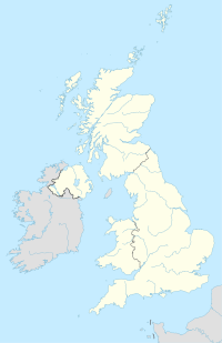
Storbritannien
- Richmond, North Yorkshire, ort i England, 54°24′13″N 1°44′04″V / 54.4036°N 1.73434°V
- Richmond, London, ort, England, Greater London, 51°27′42″N 0°18′23″V / 51.46171°N 0.30633°V
- Richmond-upon-Thames – en borough i London
Se även
- Richmond University – London
- Richmond upon Thames College – en skola i Richmond upon Thames i Storbritannien
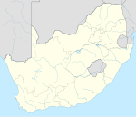
Sydafrika
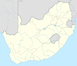
- Richmond, Norra Kapprovinsen(en), ort i Pixley ka Seme District Municipality, 31°24′48″S 23°56′43″Ö / 31.41345°S 23.94517°Ö
- Richmond, KwaZulu-Natal(en), ort i UMgungundlovu District Municipality, 29°52′19″S 30°16′20″Ö / 29.87196°S 30.27235°Ö
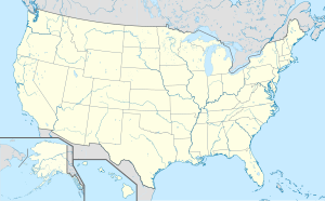
USA
- Richmond, Indiana, countyhuvudort, Wayne County, 39°49′44″N 84°53′25″V / 39.82894°N 84.89024°V
- Richmond, Kansas, ort, Franklin County, 38°24′10″N 95°15′14″V / 38.4028°N 95.25386°V
- Richmond, Kentucky, Madison County, 37°44′52″N 84°17′41″V / 37.74786°N 84.29465°V
- Richmond, Louisiana, Madison Parish, 32°23′17″N 91°10′55″V / 32.38792°N 91.18205°V
- Richmond, Missouri, Ray County, 39°16′43″N 93°58′37″V / 39.27862°N 93.97689°V
- Richmond, Texas, Fort Bend County, 29°34′56″N 95°45′39″V / 29.58218°N 95.76078°V
- Richmond, Virginia, delstatshuvudstad, City of Richmond, 37°33′14″N 77°27′37″V / 37.55376°N 77.46026°V
- Richmond, Illinois, ort i McHenry County, 42°28′33″N 88°18′21″V / 42.47585°N 88.30593°V
- Richmond, Massachusetts, ort, Berkshire County, 42°22′23″N 73°22′03″V / 42.37314°N 73.36761°V
- Richmond, Maine, Sagadahoc County, 44°05′14″N 69°47′56″V / 44.0873°N 69.79893°V
- Richmond, Michigan, Macomb County, 42°48′33″N 82°45′21″V / 42.8092°N 82.75576°V
- Richmond, Minnesota, ort, Stearns County, 45°27′15″N 94°31′06″V / 45.45413°N 94.51833°V
- Richmond, New Hampshire, ort, Cheshire County, 42°45′17″N 72°16′18″V / 42.75481°N 72.27175°V
- Richmond, Ohio, Jefferson County, 40°26′00″N 80°46′18″V / 40.4334°N 80.77175°V
- Richmond, Vermont, ort, Chittenden County, 44°24′19″N 72°59′34″V / 44.40533°N 72.9929°V
- Richmond, Kalifornien, ort, Contra Costa County, 37°56′09″N 122°20′52″V / 37.93576°N 122.34775°V
- Richmond, Utah, Cache County, 41°55′22″N 111°48′49″V / 41.92271°N 111.81356°V
- Richmond, Rhode Island, kommun (town) i Washington County, 41°30′00″N 71°39′58″V / 41.5°N 71.666°V
Se även
- University of Richmond – Virginia, USA
Se även
Media som används på denna webbplats
Shiny blue button/marker widget.
(c) Karte: NordNordWest, Lizenz: Creative Commons by-sa-3.0 de
Location map of the United Kingdom
Författare/Upphovsman: NordNordWest, Licens: CC BY 3.0
Location map of South Africa
Författare/Upphovsman: TUBS
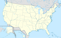
Location map of the USA (Hawaii and Alaska shown in sidemaps).
Main map: EquiDistantConicProjection : Central parallel :
* N: 37.0° N
Central meridian :
* E: 96.0° W
Standard parallels:
* 1: 32.0° N
* 2: 42.0° N
Made with Natural Earth. Free vector and raster map data @ naturalearthdata.com.
Formulas for x and y:
x = 50.0 + 124.03149777329222 * ((1.9694462586094064-({{{2}}}* pi / 180))
      * sin(0.6010514667026994 * ({{{3}}} + 96) * pi / 180))
y = 50.0 + 1.6155950752393982 * 124.03149777329222 * 0.02613325650382181
      - 1.6155950752393982  * 124.03149777329222 *
     (1.3236744353715044  - (1.9694462586094064-({{{2}}}* pi / 180))
      * cos(0.6010514667026994 * ({{{3}}} + 96) * pi / 180))
Hawaii side map: Equirectangular projection, N/S stretching 107 %. Geographic limits of the map:
- N: 22.4° N
- S: 18.7° N
- W: 160.7° W
- E: 154.6° W
Alaska side map: Equirectangular projection, N/S stretching 210.0 %. Geographic limits of the map:
- N: 72.0° N
- S: 51.0° N
- W: 172.0° E
- E: 129.0° W
Logo for disambiguation pages.
Författare/Upphovsman: NordNordWest, Licens: CC BY-SA 3.0
Plats karta över Nya Zeeland
Författare/Upphovsman: NordNordWest, Licens: CC BY-SA 3.0 de
Location map of Jamaica
Författare/Upphovsman: NordNordWest, Licens: CC BY-SA 3.0
Location map of Australia
Författare/Upphovsman: Yug, Licens: CC BY-SA 3.0
cropped version of Carte administrative du Canada.svg for map location.
