Razavikhorasan
| Razavikhorasan (خراسان رضوی) | |
| Khorasan-e Razavi | |
| Provins | |
Razavikhorasans läge i Iran | |
| Officiellt namn: Ostan-e Khorasan-e Razavi (استان خراسان رضوی) | |
| Land | |
|---|---|
| Huvudort | Mashhad |
| - koordinater | 36°17′52″N 59°36′21″Ö / 36.29778°N 59.60583°Ö |
| Area | 118 851 km²[1] |
| Folkmängd | 6 434 501 (2016)[2] |
| Befolkningstäthet | 54 invånare/km² |
| Geonames | 6201375 |

Razavikhorasan, alternativt Razavi-Khorasan eller Khorasan-e Razavi (persiska: خراسان رضوی), är en provins i nordöstra Iran. År 2016 hade den 6 434 501 invånare,[2] på en yta av 118 851 km².[1] Administrativ huvudort är Mashhad, som är Irans näst största stad. Andra större orter är Neyshabur, Quchan, Sabzevar och Torbat-e Heydariyeh.
Provinsen gränsar till både Afghanistan och Turkmenistan. Den var fram till 29 september 2004 en del av provinsen Khorasan, som då delades upp i de tre provinserna Nordkhorasan, Razavikhorsan och Sydkhorasan.
Administrativ indelning
Provinsen Razavikhorasan var vid folkräkningen 2016 indelad i 28 delprovinser (shahrestan),[2] i sin tur indelade på ytterligare administrativa nivåer.
Källor
- ^ [a b] Selected Findings of the 2016 National Population and Housing Census, Statistical Centre of Iran, augusti 2018. Läst 19 mars 2023.
- ^ [a b c] Census 2016: Population and Household of the Country by Province and Sub-province (Shahrestan), Statistical Center of Iran (SCI). Tillgänglig på Iran Data Portal. Läst 15 februari 2023.
Externa länkar
 Wikimedia Commons har media som rör Razavikhorasan.
| |||||
Media som används på denna webbplats
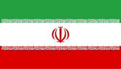
Flag of Iran. The tricolor flag was introduced in 1906, but after the Islamic Revolution of 1979 the Arabic words 'Allahu akbar' ('God is great'), written in the Kufic script of the Qur'an and repeated 22 times, were added to the red and green strips where they border the white central strip and in the middle is the emblem of Iran (which is a stylized Persian alphabet of the Arabic word Allah ("God")).
The official ISIRI standard (translation at FotW) gives two slightly different methods of construction for the flag: a compass-and-straightedge construction used for File:Flag of Iran (official).svg, and a "simplified" construction sheet with rational numbers used for this file.
(c) franek2, CC BY-SA 3.0
Border area: small fort (Iranian side)


