Rausand
| Rausand | |
| Ort | |
| Land | |
|---|---|
| Fylke | Møre og Romsdal fylke |
| Kommun | Molde kommun |
| Höjdläge | 68 m ö.h. |
| Koordinater | 62°50′6″N 8°7′23″Ö / 62.83500°N 8.12306°Ö |
| Area | 0,45 km² |
| Folkmängd | 264 (2019)[1] |
| Befolkningstäthet | 590 inv./km² |
| Tidszon | CET (UTC+1) |
| - sommartid | CEST (UTC+2) |
| Tätortskod | 6202 |
| Geonames | 3142209 |
(c) Karte: NordNordWest, Lizenz: Creative Commons by-sa-3.0 de Ortens läge i Møre og Romsdal fylke | |
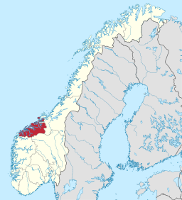
(c) Karte: NordNordWest, Lizenz: Creative Commons by-sa-3.0 de Møre og Romsdal fylke i Norge | |
Redigera Wikidata | |
Rausand (eller Raudsand) är en tätort i Molde kommun i Møre og Romsdal fylke i västra Norge. Orten ligger vid fylkesväg 666 i den östra delen av kommunen.[2]
Tidigare har orten tillhört dåvarande Nessets kommun.
Referenser
- ^ Tettsteders befolkning og areal (på norskt bokmål), Statistisk sentralbyrå, läs online.[källa från Wikidata]
- ^ Norgeskart.no
Media som används på denna webbplats
Författare/Upphovsman: Gutten på Hemsen, Licens: CC0
Flag of Norway with colors from the previous version on Commons. This file is used to discuss the colors of the Norwegian flag.
Shiny red button/marker widget. Used to mark the location of something such as a tourist attraction.
(c) Karte: NordNordWest, Lizenz: Creative Commons by-sa-3.0 de
Location of county Møre og Romsdal in Norway (2024)
(c) Karte: NordNordWest, Lizenz: Creative Commons by-sa-3.0 de
Location map of Møre og Romsdal, Norway


