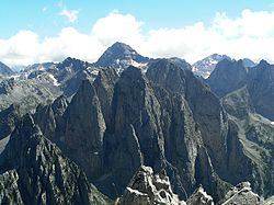
Prokletije

Albanska alperna eller Prokletije (albanska: Bjeshkët e Nemuna, Bjeshkët e Nâmuna och Alpet Shqiptare; serbiska, kyrilliska: Проклетије, serbiska, latin: Prokletije) är en bergskedja mellan norra Albanien, Kosovo och östra Montenegro.[1] De högsta topparna är Jezerca (2 694 meter över havet) i Albanien och Gjeravica (2 656 meter över havet) i Kosovo.[1] Bergkedjans namn på albanska och serbiska betyder bägge "de fördömdas berg".[1]
Bergskedjan skapades när den afrikanska kontinentalplattan krockade med den eurasiska.[1] Prokletije utgör den högsta och sydligaste delen av de 1000 km långa Dinariska alperna.[1]
Bergstoppar i Albanska alperna
- Grykat e Hapëta
- Maja e Boshit
- Maja e Çeslës
- Maja e Çet-Harushës
- Maja e Dhive
- Maja e Doborgashit
- Maja e Harapit
- Maja e Hekuravës
- Maja e Jezercës, 2694 möh (högsta topp)
- Maja e Kakisë
- Maja e Kollatës
- Maja e Peçmarës
- Maja e Rragamit
- Maja e Shtrazës
- Maja e Shtyllës
- Maja Ismet Sali Bruçaj
- Marocës Maja e
Referenser
- Elsie, Robert (2010) (på engelska). Historical Dictionary of Albania. European Historical Dictionaries, 99-2094237-5; 75 (2). Lanham, Maryland: Scarecrow. Libris 11846576. ISBN 978-0-8108-6188-6
Noter
- ^ [a b c d e] ”Prokletije” (på norska). Store norske leksikon. 2015-05-05. http://snl.no/Prokletije. Läst 1 maj 2018.
Externa länkar
 Wikimedia Commons har media som rör Prokletije.
Media som används på denna webbplats
(c) Orjen, CC BY-SA 3.0
Maja e Bojës (2461 m) and Jezerski Vrh (2694) in Prokletije seen from top of Karanfili (2480 m)
Författare/Upphovsman: Albinfo, Licens: CC BY-SA 3.0
Albanian Alps seen from the air looking East. In the center the valley and the village of Theth. In the upper part on the right the Valbona valley with Maja Roshit and Kollata to the left. Between the two valleys are the Valbona pass (Qafa e Valbonës) and the Jezerca massif with the Jezerca peak between two clouds. To the left is the Peja pass (Qafa e Pejës) and the pyramid of Maja Arapit. Behind in the upper left corner the Montenegrinian Ropojana valley and the valley of Plav with parts of Lake Plav. To the left is the Radohima massif. In the lower part can be seen the road to Theth over Terthorja pass (Qafa Terthorjës).


