Prescott
Prescott kan syfta på
Geografi
Kanada
Storbritannien
- Prescot, stad i Merseyside, England, 53°25′46″N 2°48′01″V / 53.42948°N 2.80031°V
- Prescott, Gloucestershire, ort i England, Gloucestershire, 51°57′47″N 2°00′52″V / 51.96316°N 2.01435°V
USA
- Prescott, Arkansas, countyhuvudort, Nevada County, 33°48′09″N 93°22′52″V / 33.80261°N 93.38101°V
- Prescott, Kansas, ort, Linn County, 38°03′49″N 94°41′44″V / 38.06364°N 94.69551°V
- Prescott, Iowa, Adams County, 41°01′23″N 94°36′49″V / 41.02304°N 94.61358°V
- Prescott, Michigan, Ogemaw County, 44°11′31″N 83°55′51″V / 44.19196°N 83.93082°V
- Prescott, Wisconsin, Pierce County, 44°44′56″N 92°48′08″V / 44.74886°N 92.80215°V
- Prescott, Arizona, countyhuvudort, Arizona, Yavapai County, 34°32′24″N 112°28′07″V / 34.54002°N 112.4685°V
- Prescott, Washington, Walla Walla County, 46°17′58″N 118°18′54″V / 46.29958°N 118.31497°V
Personer
- Edward C. Prescott (1940–2022) amerikansk ekonom, ekonomipristagare till Alfred Nobels minne
- John Prescott (1938–2024) brittisk politiker och minister
- Norm Prescott, en av grundarna av animeringsstudion Filmation Associates
- Prescott Bush (1895–1972) amerikansk senator
- James Prescott Joule (1818–1889) fysiker
Media som används på denna webbplats
Författare/Upphovsman: Yug, Licens: CC BY-SA 3.0
cropped version of Carte administrative du Canada.svg for map location.
Shiny blue button/marker widget.
Författare/Upphovsman: TUBS
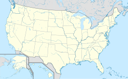
Location map of the USA (Hawaii and Alaska shown in sidemaps).
Main map: EquiDistantConicProjection : Central parallel :
* N: 37.0° N
Central meridian :
* E: 96.0° W
Standard parallels:
* 1: 32.0° N
* 2: 42.0° N
Made with Natural Earth. Free vector and raster map data @ naturalearthdata.com.
Formulas for x and y:
x = 50.0 + 124.03149777329222 * ((1.9694462586094064-({{{2}}}* pi / 180))
      * sin(0.6010514667026994 * ({{{3}}} + 96) * pi / 180))
y = 50.0 + 1.6155950752393982 * 124.03149777329222 * 0.02613325650382181
      - 1.6155950752393982  * 124.03149777329222 *
     (1.3236744353715044  - (1.9694462586094064-({{{2}}}* pi / 180))
      * cos(0.6010514667026994 * ({{{3}}} + 96) * pi / 180))
Hawaii side map: Equirectangular projection, N/S stretching 107 %. Geographic limits of the map:
- N: 22.4° N
- S: 18.7° N
- W: 160.7° W
- E: 154.6° W
Alaska side map: Equirectangular projection, N/S stretching 210.0 %. Geographic limits of the map:
- N: 72.0° N
- S: 51.0° N
- W: 172.0° E
- E: 129.0° W
Logo for disambiguation pages.
(c) Karte: NordNordWest, Lizenz: Creative Commons by-sa-3.0 de
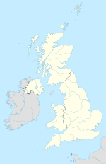
Location map of the United Kingdom


