Prachin Buri
| Den här artikeln behöver fler eller bättre källhänvisningar för att kunna verifieras. (2019-10) Åtgärda genom att lägga till pålitliga källor (gärna som fotnoter). Uppgifter utan källhänvisning kan ifrågasättas och tas bort utan att det behöver diskuteras på diskussionssidan. |
| Prachin Buri (ปราจีนบุรี) | |||
| Provins | |||
Aphai Phubet Thai, högskola för traditionell medicin. | |||
| |||
| Officiellt namn: ปราจีนบุรี | |||
| Land | |||
|---|---|---|---|
| Region | Östra Thailand | ||
| Provinshuvudstad | Prachin Buri | ||
| - koordinater | 14°03′24″N 101°22′26″Ö / 14.05667°N 101.37389°Ö | ||
| Area | 4 762 km²[1] | ||
| Folkmängd | 452 822 (2002) | ||
| Befolkningstäthet | 95 invånare/km² | ||
| Tidszon | ICT (UTC+7) | ||
| Geonames | 1906687 | ||
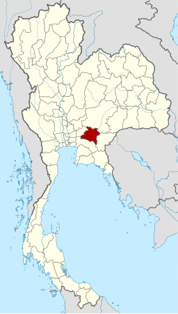
Prachin Buris läge i Thailand. | |||
Prachin Buri (thai: ปราจีนบุรี) är en thailändsk provins (changwat). Den ligger i den östra delen av Thailand. Provinsen hade år 2002 452 822 invånare på en areal av 4 762 km². Provinshuvudstaden är Prachin Buri.
Administrativ indelning
Provinsen är indelad 7 distrikt (amphoe). Distrikten är i sin tur indelade i 65 subdistrikt (tambon) och 658 byar (muban).
Referenser
Externa länkar
 Wikimedia Commons har media som rör Prachin Buri.
- Prachin Buri website
- Thailand Guidebook
| |||||||||||||||||||||||
Media som används på denna webbplats
Författare/Upphovsman: Tkgd2007, Licens: CC BY-SA 3.0
A new incarnation of Image:Question_book-3.svg, which was uploaded by user AzaToth. This file is available on the English version of Wikipedia under the filename en:Image:Question book-new.svg
The national flag of Kingdom of Thailand; there are total of 3 colours:
- Red represents the blood spilt to protect Thailand’s independence and often more simply described as representing the nation.
- White represents the religion of Buddhism, the predominant religion of the nation
- Blue represents the monarchy of the nation, which is recognised as the centre of Thai hearts.
Flag of Prachin Buri Province
Författare/Upphovsman: Khunkay, Licens: CC BY-SA 4.0
This is a photo of a monument in Thailand identified by the ID
Författare/Upphovsman: NordNordWest, Licens: CC BY 3.0
Locator map of Prachinburi Province, Thailand


