Porto Cesareo
| Porto Cesareo | |
| Kommun | |
| Officiellt namn: Comune di Porto Cesareo | |
| Land | |
|---|---|
| Region | Apulien |
| Provins | Lecce |
| Höjdläge | 3 m ö.h. |
| Yta | 35,12 km²[1] |
| Folkmängd | 6 272 (2017)[2] |
| Befolkningstäthet | 179 invånare/km² |
| Tidszon | CET (UTC+1) |
| - sommartid | CEST (UTC+2) |
| Postnummer | 73010 |
| Riktnummer | (+39) 0833 |
| ISTAT-kod | 075097 |
| Geonames | 6540770 |
| Skyddspatron | Jungfru Maria |
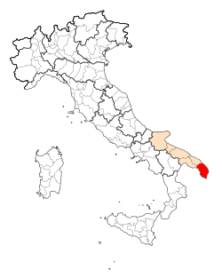
Kommunens läge i Italien | |
Kommunens läge i Lecce | |
| Webbplats: Porto Cesareo | |
Porto Cesareo är en liten stad i Tarantobukten i provinsen Lecce, Apulien i södra Italien. Kommunen hade 6 272 invånare (2017).[2] Porto Cesareo gränsar till kommunerna Avetrana, Manduria och Nardò.
Utanför ligger Isola dei Conigli, "Kaninön". Längs stranden finns det naturreservat för sanddynerna som en gång Apulien var fullt av längs kusterna.
Torre Cesarea
Torre Chianca
Torre Lapillo
Torre Castiglione
Referenser
- ^ ”Geomorphological characteristics of municipalities”. 2017. Arkiverad från originalet den 16 maj 2019. https://web.archive.org/web/20190516211155/http://dati.istat.it//Index.aspx?QueryId=34711. Läst 28 augusti 2019.
- ^ [a b] ”Statistiche demografiche ISTAT”. demo.istat.it. Arkiverad från originalet den 16 juli 2018. https://web.archive.org/web/20180716065929/http://demo.istat.it/bilmens2017gen/index.html. Läst 28 augusti 2019.
Media som används på denna webbplats
Författare/Upphovsman: Eric Gaba (Sting - fr:Sting) and NordNordWest, Licens: CC BY-SA 3.0
Blank physical map of Italy including the 08-2009 modification of the boundary between Emilia-Romagna and Marche regions, for geo-location purpose.
Map of the Provincia of Lecce.
(c) italian wikipedia user florixc, CC-BY-SA-3.0
Torre chianca si trova qui 40°16′18″N 17°52′14″E / 40.27167°N 17.87056°E
Map of the municipality (comune) of Porto Cesareo (province of Lecce, region Apulia, Italien)
(c) italian wikipedia user florixc, CC-BY-SA-3.0
Torre castiglione ormai è un cumulo di macerie..
si trova qui 40°17′13″N 17°49′10″E / 40.28694°N 17.81944°E(c) italian wikipedia user florixc, CC-BY-SA-3.0
Questa è proprio la torre dentro porto cesareo:Torre Cesarea.. dal cielo si vede così
| Objektposition | | Se denna och andra närliggande bilder på: OpenStreetMap |
|---|
(c) italian wikipedia user florixc, CC-BY-SA-3.0
è la torre di Torre Lapillo, frazione di Porto Cesareo ed è stata restaurata di recente. lo scatto è di qualche giorno fa. La foto l'ha fatta mia cugino x me.
Dal satellite si vede così| Kameraposition | | Se denna och andra närliggande bilder på: OpenStreetMap |
|---|


