Portal:Mars
| Denna sida är museimärkt och hålls inte längre uppdaterad. Den behålls främst av historiska skäl. Se eventuellt diskussionssidan för mer information. |
P O R T A L : M A R S | |||||||||||
| |||||||||||
| |||||||||||
Media som används på denna webbplats
Museum icon
Global mosaic of 102 Viking 1 Orbiter images of Mars taken on orbit 1,334, 22 February 1980. The images are projected into point perspective, representing what a viewer would see from a spacecraft at an altitude of 2,500 km. At center is Valles Marineris, over 3000 km long and up to 8 km deep. Note the channels running up (north) from the central and eastern portions of Valles Marineris to the area at upper right, Chryse Planitia. At left are the three Tharsis Montes and to the south is ancient, heavily impacted terrain. (Viking 1 Orbiter, MG07S078-334SP)
Some of the features in this mosaic are annotated in Wikimedia Commons.
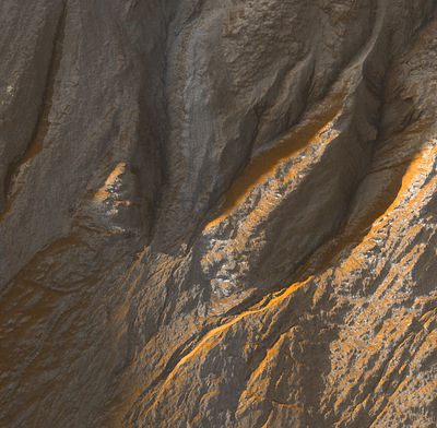
Gullies on a crater wall at Terra Sirenum, Mars. Picture taken by HiRISE on NASA:s Mars Reconnaissance Orbiter. Image centered at -38.9 degrees latitude, 223.7 degrees East longitude. Range to target site was 251.8 km (157.4 miles). The image scale is 50.4 cm/pixel (with 2 x 2 binning) which means objects ~151 cm across are resolved. This image is a part of a larger image which can be found at: http://hiroc.lpl.arizona.edu/images/TRA/TRA_000878_1410/color.html
Mars Reconnaissance Orbiter over Nilosyrtis Mensae - NASA's Mars Reconnaissance Orbiter passes above a portion of the planet called Nilosyrtis Mensae in this artist's concept illustration. NASA plans to launch this multipurpose spacecraft in August 2005 to advance our understanding of Mars through detailed observation, to examine potential landing sites for future surface missions and to provide a high-data-rate communications relay for those missions.
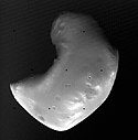
Viking 2 Orbiter image of the Martian satellite Deimos taken from 1400 km. Deimos appears smooth, but higher resolution images taken during closer approaches show the surface is covered with craters, but many of these have been partially buried or subdued by regolith. Deimos is about 14 km from top to bottom in this image.
Info icon with hourglass


