Port Costa, Kalifornien
| Port Costa, Kalifornien | |
| CDP | |
| Land | |
|---|---|
| Delstat | |
| County | Contra Costa County |
| Höjdläge | 4 m ö.h. |
| Koordinater | 38°2′47″N 122°11′0″V / 38.04639°N 122.18333°V |
| Area | 0,41 km² (2010)[1] |
| Folkmängd | 190 (2010)[1][2][3] |
| Befolkningstäthet | 463 invånare/km² |
| Tidszon | PST (UTC-8) |
| - sommartid | PDT (UTC-7) |
| ZIP-kod | 94569 |
| Riktnummer | 510 |
| GNIS-kod | 230948 |
| Geonames | 5384333 |
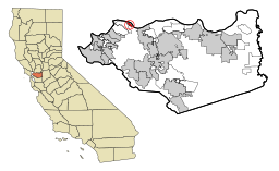
Översiktskarta | |
Kaliforniens läge i USA | |
| Wikimedia Commons: Port Costa, California | |
| Redigera Wikidata | |

Port Costa är en ort (census-designated place) i Contra Costa County i västra Kalifornien, med 190 invånare vid 2010 års federala folkräkning.
Geografi
Port Costa är beläget vid södra sidan av Carquinezsundet där Sacramento River och San Joaquin River har sitt gemensamma utlopp i San Francisco Bay.
Historia
Orten grundades 1879 som ett färjeläge för en järnvägsfärja, för Central Pacific Railroads del av den transamerikanska järnvägen. Här korsade tågen Carquinezsundet från Benicia och anslöt till den västligaste järnvägssträckan mot Oakland. Det första postkontoret öppnades 1881. Orten blev senare även en betydande hamn för utskeppning av vete från Kalifornien.
I samband med att veteexporten minskade och att en ny järnvägsbro uppfördes 1930 vid Martinez kom orten att förlora sin betydelse som hamn. Sedan 1960-talet är Port Costa mest känt för sina antikhandlare och som samlingsplats för MC-entusiaster.
Källor
- Den här artikeln är helt eller delvis baserad på material från engelskspråkiga Wikipedia, Port Costa, California.
- ^ [a b] United States Census Bureau, 2010 U.S. Gazetteer Files, United States Census Bureau, 2010, läst: 9 juli 2020.[källa från Wikidata]
- ^ United States Census Bureau (red.), USA:s folkräkning 2020, läs online, läst: 1 januari 2022.[källa från Wikidata]
- ^ United States Census Bureau (red.), United States Census 2010, läs online, läst: 10 maj 2022.[källa från Wikidata]
Media som används på denna webbplats
Flag of California. This version is designed to accurately depict the standard print of the bear as well as adhere to the official flag code regarding the size, position and proportion of the bear, the colors of the flag, and the position and size of the star.
Författare/Upphovsman: Huebi, Licens: CC BY 2.0
Map of USA with California highlighted
Författare/Upphovsman: Sinjutchupti, Licens: CC BY-SA 4.0
The town of Port Costa as seen from Carquinez Strait Regional Shoreline Park, with Carquinez Strait in the background. Across the strait is the town of Benicia.
Författare/Upphovsman: Sanfranman59, Licens: CC BY-SA 3.0
w:National Register of Historic Places listings in Contra Costa County, California. Port Costa School, Plaza El Hambre, Port Costa, California, USA. Photographed 2008-09-14 from the southwest corner of Reservoir St. and Canyon Lake Dr.
|
This is an image of a place or building that is listed on the National Register of Historic Places in the United States of America. Its reference number is 88000563. |
Författare/Upphovsman: Arkyan, Licens: CC BY-SA 3.0
This map shows the incorporated and unincorporated areas in Contra Costa County, California, highlighting Port Costa in red. It was created with a custom script with US Census Bureau data and modified with Inkscape.


