Pinar del Río
| Pinar del Río | |
| Kommun | |
Pinar del Río | |
| Officiellt namn: Municipio de Pinar del Río | |
| Land | |
|---|---|
| Provins | Provincia de Pinar del Río |
| Höjdläge | 61 m ö.h. |
| Koordinater | 22°24′44″N 83°42′00″V / 22.41222°N 83.70000°V |
| Area | 731 km² |
| Folkmängd | 188 614 (2012-09-14)[1] |
| - tätort | 140 230 (2012-09-14)[2] |
| Befolkningstäthet | 258 invånare/km² |
| Grundades | 10 september 1867 |
| Tidszon | CST (UTC-5) |
| - sommartid | CDT (UTC-4) |
| Postnummer | 20100-20300 |
| Riktnummer | +53 48 |
| Geonames | 3544089 |
Läge i Kuba | |
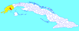
Kommunens läge i Kuba | |
Pinar del Río är en kommun och stad i västra Kuba, 160 kilometer sydväst om Havanna, huvudstad i provinsen Pinar del Río. Staden hade 140 230 invånare 2012.[2]
Pinar del Río är främst känd för sin tobaksindustri.
Referenser
Noter
- ^ ”Pinar del Río (Municipality, Cuba) - Population Statistics, Charts, Map and Location” (på engelska). www.citypopulation.de. http://www.citypopulation.de/php/cuba-admin.php?adm2id=2108. Läst 29 september 2017.
- ^ [a b] ”Cuba: Provinces, Major Cities & Towns - Population Statistics in Maps and Charts” (på engelska). www.citypopulation.de. https://www.citypopulation.de/Cuba-Cities.html. Läst 29 september 2017.
Källor
- Carlquist, Gunnar, red (1937). Svensk uppslagsbok. Bd 21. Malmö: Svensk Uppslagsbok AB. sid. 659
Externa länkar
 Wikimedia Commons har media som rör Pinar del Río.
Media som används på denna webbplats
Författare/Upphovsman: User:Urutseg, Licens: CC0
Stretched version of Cuba physical map.svg in order to be compatible with File:Cuba location map.svg
Shiny red button/marker widget. Used to mark the location of something such as a tourist attraction.
Författare/Upphovsman: Mmoyaq, Licens: CC BY-SA 3.0
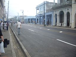
Carrer José Martí a Pinar del Rio
Författare/Upphovsman: Dэя-Бøяg, Licens: CC BY-SA 3.0
A map of the municipality of Pinar del Río (shown in red) within the Province of Pinar del Río (yellow) and Cuba.


