Piliscsaba
| Piliscsaba | |||
| stad | |||
Pázmány Péter Katolikus Egyetem sedd från luften. | |||
| |||
| Indelning | Pest | ||
|---|---|---|---|
| Koordinater | 47°37′55″N 18°49′34″Ö / 47.63194°N 18.82611°Ö | ||
| Yta | 25,55 km²[1] | ||
| Folkmängd | 8 053 (2015)[1] | ||
| Befolkningstäthet | 315 invånare/km² | ||
| Tidszon | UTC+1 | ||
| - sommartid | UTC+2 | ||
| Geonames | 3046353 | ||
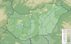
Piliscsabas läge i Ungern | |||
| Webbplats: http://www.piliscsaba.hu/ | |||
Piliscsaba är en stad i Pest i Ungern. Staden har en yta på 25,55 km2, och den hade 8 053 invånare år 2015.
| Befolkningsutvecklingen i Piliscsaba 1980–2015[1] | ||||
|---|---|---|---|---|
| År | Folkmängd | |||
| 1980 | 4 485 | |||
| 1990 | 4 463 | |||
| 2015 | 8 053 | |||
Referenser
- ^ [a b c] www.citypopulation.de
Media som används på denna webbplats
Författare/Upphovsman: Urutseg, Licens: CC0
Hungary physical map, parameters equal to File:Hungary location map.svg
Shiny red button/marker widget. Used to mark the location of something such as a tourist attraction.
Författare/Upphovsman: Kaboldy, Licens: CC BY-SA 3.0
Coat of arms of Piliscsaba, Hungary
Författare/Upphovsman: Okänd, Licens: CC BY-SA 2.5
University - Piliscsaba - Hungary - Europe


