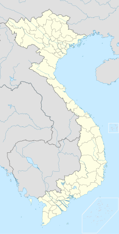
Phu Quoc Internationell flygplats
| Phu Quoc internationella flygplats | |||||||||||
| Allmän information | |||||||||||
|---|---|---|---|---|---|---|---|---|---|---|---|
| Ort | Phu Quoc | ||||||||||
| Flygplatstyp | Internationell flygplats | ||||||||||
| IATA-kod | PQC | ||||||||||
| ICAO-kod | VVPQ | ||||||||||
| Driftbolag | Airports Corporation of Vietnam | ||||||||||
| Höjd över havet | ? | ||||||||||
| Koordinater | 10°13′33″N 103°57′39″Ö / 10.22583°N 103.96083°Ö | ||||||||||
| Terminalyta (m2) | 1 | ||||||||||
| Kommunikationer | |||||||||||
| Restid/Sträcka från centrum | 5 km | ||||||||||
| Parkering | Parkeringshus, långtidsparkering, korttidsparkering | ||||||||||
| Banor | |||||||||||
| |||||||||||
| Statistik | |||||||||||
| Varav inrikes (-) | - | ||||||||||
| Varav utrikes (-) | - | ||||||||||
Phu Quoc Internationell flygplats (Sân bay quốc tế Phú Quốc) är en internationell flygplats, på ön Phu Quoc i Kien Giang, Vietnam. Flygplatsen ersätter Phu Quoc flygplats som ligger 10 km bort. Flygplatsen öppnades den 2 december 2012.[1][2] Kapaciteten var initialt 2,5 miljoner passagerare per år och maximal kapacitet är 7 miljoner passagerare per år.
Flygbolag och destinationer
| Flygbolag | Destinationer |
|---|---|
| Jetstar Pacific Airlines | Hanoi, Ho Chi Minh-staden |
| Thomson Airways | Stockholm-Arlanda, Helsingfors [1 december 2017], London-Gatwick [1 december 2017] |
| Vietnam Airlines | Hanoi, Ho Chi Minh-staden, Can Tho, Rach Gia |
| VietJet Air | Ho Chi Minh-staden[12/12/2012] |
Referenser
- ^ ”Phu Quoc International Airport to open December 2”. Tuoi Tre Newspaper. 1 december 2012. Arkiverad från originalet den 4 december 2012. https://web.archive.org/web/20121204055221/http://www.tuoitrenews.vn/cmlink/tuoitrenews/society/phu-quoc-international-airport-to-open-december-2-1.93234. Läst 1 december 2012.
- ^ ”Vietnam Airlines capitalises on new Phu Quoc airport”. Voice of Vietnam. 3 december 2012. Arkiverad från originalet den 10 september 2015. https://web.archive.org/web/20150910193623/http://english.vov.vn/Travel/Vietnam-Airlines-capitalises-on-new-Phu-Quoc-airport/251013.vov. Läst 3 december 2012.
| ||||||||||||||
Media som används på denna webbplats
Shiny red button/marker widget. Used to mark the location of something such as a tourist attraction.
Författare/Upphovsman: Uwe Dedering, Licens: CC BY-SA 3.0
Location map of Vietnam.
Equirectangular projection. Strechted by 104 %. Geographic limits of the map:
- N: 24.0° N
- S: 8.0° N
- W: 101.8° E
- E: 110.3° E
Paracel Islands (map between). Equirectangular projection. Stretched by 52%. Geographic limits of the map:
- N: 17°15′ N
- S: 15°45′ N
- W: 111°00′ E
- E: 113°00′ E
Spratly Islands (map below). Equirectangular projection. Stretched by 41.6%. Geographic limits of the map:
- N: 12°00' N
- S: 6°12' N
- W: 111°30' E
- E: 117°20' E


