Pfaffenthal
| Pfaffenthal Paafendall | |
| Stadsdel | |
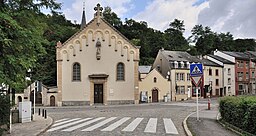
Pfaffenthal vid bron över Alzette. | |
| Land | Luxemburg |
|---|---|
| Stad (tätort) | Luxemburg |
| Koordinater | 49°36′57″N 6°7′55″Ö / 49.61583°N 6.13194°Ö |
| Area | 0,38 km²[1] |
| Folkmängd | 1 234 (december 2019)[2] |
| Befolkningstäthet | 3 247 invånare/km² |
| Geonames | 2960182 |

Pfaffenthal (Paafendall) är en stadsdel i staden Luxemburg i Luxemburg. Pfaffenthal ligger 270 meter över havet[3]
Pfaffenthal har en järnvägsstation, Pfaffenthal-Kirchberg. Den är förbunden med den ovanförliggande stadsdelen Kirchberg och Luxemburgs spårväg med Bergbanan Pfaffenthal–Kirchberg.
Från Pfaffenthal finns också en av staden ägd och driven hiss till Uewerstad.
Bildgalleri
- Pfaffental sedd från Bock mot Stohertiginnan Charlottebron över Alizette till Kirchberg.
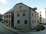
- Hospice civil vid rue Mohrfels
- Muerbelskvarnarna.
- Béinchenbron (omkring 1786) och Stohertiginnan Charlottebron (1965) över Alzette.
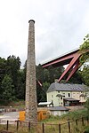
- Skorstenen "Féngerlek", som tillhört en tidigare vattenpumpstation.
- Vy åt sydöst.
- Kirchberg-Pfaffenthal järnvägsstation.
- Bergbanan Pfaffenthal–Kirchberg.
- Hissen mellan Pafendall och Uewerstad.
Källor
Noter
- ^ ”Pfaffenthal” (på franska). www.vdl.lu. Ville de Luxembourg. https://www.vdl.lu/la-ville/en-bref/les-24-quartiers-de-la-ville/pfaffenthal. Läst 17 februari 2018.
- ^ ”Statisiques sur la Ville de Luxembourg: Etat de Population - 2019” (på franska). www.vdl.lu. Ville de Luxembourg. https://www.vdl.lu/sites/default/files/media/document/Etat%20de%20la%20population%202019_0.pdf. Läst 17 februari 2020.
- ^ Pfaffenthal hos GeoNames.Org (cc-by); post uppdaterad 2012-01-18; databasdump nerladdad 2015-11-01
Externa länkar
 Wikimedia Commons har media som rör Pfaffenthal.
- Webbplats för Pfaffenthal
| |||||||
Media som används på denna webbplats
Författare/Upphovsman: Cayambe, Licens: CC BY-SA 3.0
Luxembourg City, quarter of Pfaffenthal: church as seen from the bridge over the Alzette river.
Författare/Upphovsman: Smiley.toerist, Licens: CC BY-SA 4.0
De kabelspoorbaan bij Pfaffenthal-Kirchberg
Författare/Upphovsman: GilPe, Licens: CC BY-SA 3.0 lu
Haiser 67 an 69 an der Muerbels (rue Mohrfels) zu Lëtzebuerg-Pafendall, gehéiert zu den nationale Monumenter an der Gemeng Lëtzebuerg.
Författare/Upphovsman: Zinneke, Licens: CC BY-SA 3.0
De Lift Pafendall-Uewerstad
Författare/Upphovsman: GilPe, Licens: CC BY-SA 3.0
Luxembourg: le quartier Pfaffenthal. Vue en direction sud-est
Författare/Upphovsman: Spedona, Licens: CC BY-SA 3.0
Blason de Luxembourg-ville
Författare/Upphovsman: Zinneke, Licens: CC BY-SA 3.0
Chimney, called "Féngerlek", of a former water pumping station in Pafendall/Pfaffenthal, Luxembourg city.
Författare/Upphovsman: Pudelek (Marcin Szala), Licens: CC BY-SA 3.0
Luxembourg City - Paafendall (Pfaffenthal) district. View from Bock
Map of Luxembourg City, Luxembourg, with the boundaries of the city's twenty-four quarters demarcated and the quarter of Pfaffenthal highlighted in blue.
Författare/Upphovsman: Cayambe, Licens: CC BY-SA 3.0
Luxembourg City, Pfaffenthal, two bridges. (1) the bridge called Béinchen, erected around 1786, part of the defensive walls of the ancient Luxembourg fortress. (2) Grande-Duchesse-Charlotte-Bridge, inaugurated in 1965. In the foreground: the Alzette river. The place shown is part of a World Heritage Site.
Författare/Upphovsman: MMFE, Licens: CC BY-SA 4.0
- Centre: Kirchberg-Pfaffenthal railway station and the accompanying funicular line is in the foreground.
- Top right: The Grand Duchess Charlotte Bridge (also known as the red bridge).
- Top left: The European Investment Bank and golden towers of the Court of Justice of the European Union.
Författare/Upphovsman: MMFE, Licens: CC BY-SA 3.0
The Hospice civil in the rue Mohrfels in Luxembourg-Pfaffenthal


