Pettnau
| Pettnau | ||
| Kommun | ||
Pettnau | ||
| ||
| Land | ||
|---|---|---|
| Förbundsland | Tyrolen | |
| Distrikt | Innsbruck-Land | |
| Höjdläge | 628 m ö.h. | |
| Koordinater | 47°17′32″N 11°09′23″Ö / 47.29222°N 11.15639°Ö | |
| Area | 10,78 km²[1] | |
| Folkmängd | 1 114 (1 januari 2024)[2] | |
| Befolkningstäthet | 103 invånare/km² | |
| Borgmästare | Martin Schwaninger (Allgemeine Liste Pettnau) | |
| Tidszon | CET (UTC+1) | |
| - sommartid | CEST (UTC+2) | |
| Postnummer | 6408 | |
| Riktnummer | 05238 | |
| Kommunkod | 7 03 39 | |
| Geonames | 7872543 | |
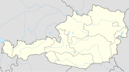
(c) Karte: NordNordWest, Lizenz: Creative Commons by-sa-3.0 de Läge i Österrike | ||
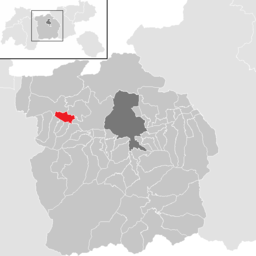
Kommunens läge i distriktet Innsbruck-Land | ||
| Webbplats: www.pettnau.at | ||
Pettnau är en ort och kommun i distriktet Innsbruck-Land i förbundslandet Tyrolen i Österrike. Kommunen har 1 114 invånare (2024). Den ligger 18 km väster om Tyrolens huvudstad Innsbruck.
Referenser
- ^ ”Gemeindeverzeichnis 2024” (på tyska) (.ods). Statistik Austria. https://www.statistik.at/fileadmin/pages/453/RegGemVz2024.ods. Läst 20 augusti 2024.
- ^ ”Bevölkerung zu Jahresbeginn nach administrativen Gebietseinheiten (Bundesländer, NUTS-Regionen, Bezirke, Gemeinden) seit 2002” (på tyska) (.ods). Statistik Austria. https://www.statistik.at/fileadmin/pages/405/Bev_Zeitreihe_Jahresbeginn_Gebietseinheiten_2024.ods. Läst 20 augusti 2024.
Externa länkar
 Wikimedia Commons har media som rör Pettnau.
- Officiell webbplats
| |||||||
Media som används på denna webbplats
(c) Karte: NordNordWest, Lizenz: Creative Commons by-sa-3.0 de
Location map of Austria
Shiny red button/marker widget. Used to mark the location of something such as a tourist attraction.
Författare/Upphovsman: W.gut.775, Licens: CC BY-SA 3.0
Picture of Pettnau with Dirschenbach, Leiblfing, Kellertal, Mitterpettnau, Kellertal and Oberpettnau (from right to left)
This image is in the public domain according to Austrian copyright law because it is part of a law, ordinance or official decree issued by an Austrian federal or state authority, or because it is of predominantly official use. (§7 UrhG)
To uploader: Please provide where the image was first published and who created it.
Författare/Upphovsman: Joschi Täubler, Licens: CC BY-SA 3.0
District Innsbruck Land


