Perth
Perth kan syfta på
Geografi
Australien
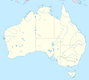
- Perth, Western Australia, delstatshuvudstad, City of Perth, 31°57′08″S 115°51′41″Ö / 31.95224°S 115.8614°Ö
- Perth, Tasmanien, Northern Midlands, 41°34′20″S 147°10′15″Ö / 41.57231°S 147.17096°Ö
Kanada
Storbritannien
- Perth, Skottland, grevskapshuvudort, Skottland, Perth and Kinross, 56°23′43″N 3°25′53″V / 56.39522°N 3.43139°V en stad i centrala Skottland och den ursprungliga orten som andra orter är namngivna efter
USA
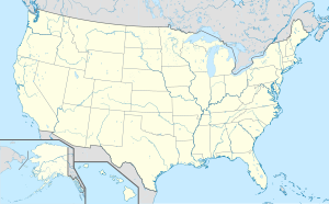
- Perth, Delaware, USA, 39°48′13″N 75°31′26″V / 39.803611°N 75.523889°V
- Perth, New York, Fulton County, New York, USA, 43°01′03″N 74°11′38″V / 43.01757°N 74.19402°V
- Perth Amboy, New Jersey, USA, 40°31′10″N 74°16′31″V / 40.519444°N 74.275278°V
- Perth, Indiana, USA, 39°35′35″N 87°09′43″V / 39.593056°N 87.161944°V
- Perth, Kansas, USA, 37°10′29″N 97°30′19″V / 37.174722°N 97.505278°V
- Perth, Minnesota, USA, 44°04′47″N 94°21′32″V / 44.079722°N 94.358889°V
- Perth, North Dakota, USA, 48°42′56″N 99°27′30″V / 48.715556°N 99.458333°V
- Perth Township, Walsh County, North Dakota, USA, 48°13′40″N 98°05′13″V / 48.227778°N 98.087°V
Personer
- Duke of Perth, en titel som gavs till James Drummond
Militär
- Blackburn Perth, en brittisk militär flygbåtstyp som flögs första gången 1934
- HMAS Perth, tre örlogsfartyg i Royal Australian Navy
- Perth-klass jagare, en fartygsklass som används i Royal Australian Navy
Media
- Perth, en singaporiansk film från 2004
Sport
- Perth Glory FC, fotbollsklubb från den australiensiska staden Perth
Se även
- 3953 Perth, asteroid
- Perthdeklarationen, 1968
- The Fair Maid of Perth, en roman av Sir Walter Scott
- Perthfördraget, 1266
Media som används på denna webbplats
Shiny blue button/marker widget.
Logo for disambiguation pages.
Författare/Upphovsman: TUBS
Location map of the USA (Hawaii and Alaska shown in sidemaps).
Main map: EquiDistantConicProjection : Central parallel :
* N: 37.0° N
Central meridian :
* E: 96.0° W
Standard parallels:
* 1: 32.0° N
* 2: 42.0° N
Made with Natural Earth. Free vector and raster map data @ naturalearthdata.com.
Formulas for x and y:
x = 50.0 + 124.03149777329222 * ((1.9694462586094064-({{{2}}}* pi / 180))
      * sin(0.6010514667026994 * ({{{3}}} + 96) * pi / 180))
y = 50.0 + 1.6155950752393982 * 124.03149777329222 * 0.02613325650382181
      - 1.6155950752393982  * 124.03149777329222 *
     (1.3236744353715044  - (1.9694462586094064-({{{2}}}* pi / 180))
      * cos(0.6010514667026994 * ({{{3}}} + 96) * pi / 180))
Hawaii side map: Equirectangular projection, N/S stretching 107 %. Geographic limits of the map:
- N: 22.4° N
- S: 18.7° N
- W: 160.7° W
- E: 154.6° W
Alaska side map: Equirectangular projection, N/S stretching 210.0 %. Geographic limits of the map:
- N: 72.0° N
- S: 51.0° N
- W: 172.0° E
- E: 129.0° W
Författare/Upphovsman: NordNordWest, Licens: CC BY-SA 3.0
Location map of Australia
Författare/Upphovsman: Yug, Licens: CC BY-SA 3.0
cropped version of Carte administrative du Canada.svg for map location.
(c) Karte: NordNordWest, Lizenz: Creative Commons by-sa-3.0 de
Location map of the United Kingdom


