Pembroke, Georgia
| Pembroke | |
| city | |
| Land | |
|---|---|
| Delstat | Georgia |
| County | Bryan County |
| Höjdläge | 28 m ö.h. |
| Koordinater | 32°8′24″N 81°37′25″V / 32.14000°N 81.62361°V |
| Yta | 20 km² (2010) |
| - land | 20 km² |
| - vatten | 0 km² |
| Folkmängd | 2 196 (2010) |
| Befolkningstäthet | 110 invånare/km² |
| Tidszon | EST (UTC-5) |
| - sommartid | EDT (UTC-4) |
| ZIP-kod | 31321 |
| FIPS | 1360004 |
| Geonames | 4215251 |
Ortens läge i Georgia | |
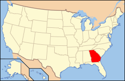
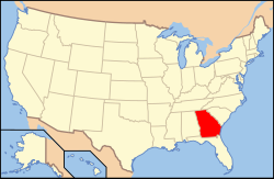
Georgias läge i USA | |
| Webbplats: http://www.pembrokega.net/ | |
Pembroke är administrativ huvudort i Bryan County i Georgia.[1][2] Pembroke uppstod i slutet av 1800-talet som järnvägsort och fick sitt namn efter ortsbon Pembroke Whitfield Williams. År 1905 fick Pembroke status som kommun.[3] Enligt 2010 års folkräkning hade orten 2 196 invånare.[4]
Kända personer från Pembroke
- Jabbo Smith, jazzmusiker
Källor
- ^ Georgia County Map with County Seat Cities. Geology.com Geoscience News and Information. Läst 9 juni 2016.
- ^ Profile for Pembroke, Georgia Arkiverad 10 augusti 2016 hämtat från the Wayback Machine.. ePodunk. Läst 9 juni 2016.
- ^ Pembroke. Georgia.gov Läst 9 juni 2016.
- ^ 2010 Census Population of Pembroke, Georgia Arkiverad 7 augusti 2016 hämtat från the Wayback Machine.. Census Viewer. Läst 9 juni 2016.
|
Media som används på denna webbplats
Författare/Upphovsman: Alexrk2, Licens: CC BY 3.0
Den här Det karta skapades med GeoTools.
Shiny red button/marker widget. Used to mark the location of something such as a tourist attraction.
Författare/Upphovsman: This version: uploader
Base versions this one is derived from: originally created by en:User:Wapcaplet, Licens: CC BY 2.0
Map of USA with Georgia highlighted
Författare/Upphovsman: Bubba73 (Jud McCranie), Licens: CC BY-SA 3.0
Pembroke Historic District. The road pictured is US 280 and the buildings near the center are separated by Main Street.


