Peabody, Massachusetts
| Peabody | |
| Stad (city) | |
| Uppkallad efter: George Peabody | |
| Land | |
|---|---|
| County | Essex County |
| Höjdläge | 5 m ö.h. |
| Koordinater | 42°31′40″N 70°55′45″V / 42.52778°N 70.92917°V |
| Area | 43,49 km² (2010)[2] |
| Folkmängd | 54 481 (2020)[3] |
| Befolkningstäthet | 1 253 invånare/km² |
| Grundad | 1626[1] |
| Tidszon | |
| GNIS-kod | 614307 |
| Geonames | 4946863 |
Översiktskarta | |
| Wikimedia Commons: Peabody, Massachusetts | |
| Webbplats: http://www.peabody-ma.gov/ | |
| Redigera Wikidata | |

Peabody, stad i Essex County, Massachusetts, USA med cirka 48 129 invånare (2000). Den har enligt United States Census Bureau en area på 43,7 km².
Referenser
- ^ hämtat från: engelskspråkiga Wikipedia.[källa från Wikidata]
- ^ United States Census Bureau, 2010 U.S. Gazetteer Files, United States Census Bureau, 2010, läst: 9 juli 2020.[källa från Wikidata]
- ^ United States Census Bureau (red.), USA:s folkräkning 2020, läs online, läst: 1 januari 2022.[källa från Wikidata]
| ||||||||||
Media som används på denna webbplats
Författare/Upphovsman: John Phelan, Licens: CC BY 3.0
General Gideon Foster House, Peabody Massachusetts
|
This is an image of a place or building that is listed on the National Register of Historic Places in the United States of America. Its reference number is 76000287. |
Författare/Upphovsman: Rcsprinter123, Licens: CC BY 3.0
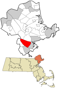
Map showing the location of this town within Essex County, Massachusetts. Data source: 2010 U.S. census
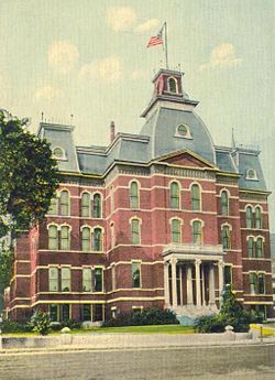
City Hall, Peabody, MA; from a 1912 postcard.


