Payson, Arizona
- En ort med samma namn finns på Payson, Illinois
- Payson, betalningstjänst på internet, ägd av Svea Bank
| Payson | |
| town | |
Geografiskt läge i Gila County och delstaten Arizona | |
| Land | |
|---|---|
| Delstat | Arizona |
| County | Gila County |
| Höjdläge | 1 500 m ö.h. |
| Koordinater | 34°14′38″N 111°19′7″V / 34.24389°N 111.31861°V |
| Yta | 50,4 km² (2010)[1] |
| - land | 50,4 km² |
| - vatten | 0 km² |
| Folkmängd | 15 301 (2010)[2] |
| Befolkningstäthet | 304 invånare/km² |
| Borgmästare | Bob Edwards |
| Tidszon | MST (UTC-7) |
| ZIP-kod | 85541[3] |
| FIPS | 0453700 |
| Geonames | 5308305 |
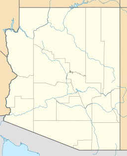
Ortens läge i Arizona | |
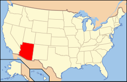
Arizonas läge i USA | |
Payson är en stad i den amerikanska delstaten Arizona med en yta av 50,4 km² och en befolkning, som uppgår till cirka 14 279 invånare (2005).
Staden är belägen i den centrala delen av delstaten cirka 110 km nordost om huvudstaden Phoenix.
Källor
- ^ ”2010 Census Gazetteer Files”. US Census Bureau. Arkiverad från originalet den 14 juli 2012. https://www.webcitation.org/699nOulzi?url=http://www.census.gov/geo/www/gazetteer/files/Gaz_places_national.txt. Läst 14 juli 2012.
- ^ ”Payson (town), Arizona” (på engelska). State & County Quickfacts. U.S. Census Bureau,. Arkiverad från originalet den 10 juni 2012. https://www.webcitation.org/68JhPPo3S?url=http://quickfacts.census.gov/qfd/states/04/0453700.html. Läst 10 juni 2012.
- ^ ”2010 ZIP Code Tabulation Area (ZCTA) Relationship Files”. U.S. Census Bureau. 27 mars 2010. Arkiverad från originalet den 25 augusti 2012. https://www.webcitation.org/6ABdwXxbq?url=http://www.census.gov/geo/www/2010census/zcta_rel/zcta_place_rel_10.txt. Läst 25 augusti 2012.
| ||||||||||
Media som används på denna webbplats
Shiny red button/marker widget. Used to mark the location of something such as a tourist attraction.
Författare/Upphovsman: Huebi, Licens: CC BY 2.0
Map of USA with Arizona highlighted
Författare/Upphovsman: NordNordWest, Licens: CC BY-SA 3.0
Location map of Arizona, USA
This map shows the incorporated areas and unincorporated areas in Gila County, Arizona.
- Payson is highlighted in red.
- Incorporated cities are shown in gray and unincorporated communities or CDPs are shown in white. Data for the borders and locations are based on maps from the US Census Bureau TIGER Map Server. I created this map in Inkscape.


