Parrotspitze
| Den här artikeln behöver källhänvisningar för att kunna verifieras. (2024-10) Åtgärda genom att lägga till pålitliga källor (gärna som fotnoter). Uppgifter utan källhänvisning kan ifrågasättas och tas bort utan att det behöver diskuteras på diskussionssidan. |
| Parrotspitze (Punta Parrot) | |
| Berg | |
| Länder | |
|---|---|
| Delstater | |
| Bergskedja | Monte Rosa |
| Höjdläge | 4 432 m ö.h. |
| Primärfaktor | 136 m |
| Koordinater | 45°55′11″N 7°52′17″Ö / 45.91972°N 7.87139°Ö |
| Bestegs först | Reginald S. Macdonald Florence Crauford Grove Montagu Woodmass William Edward Hall |
| - datum | 16 augusti 1863 |
| Geonames | 3171441 |
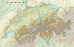
Parrotspitzes läge i Schweiz. | |
Parrotspitze, italienska: Punta Parrot, är en 4 432 meter hög bergstopp i Monte Rosamassivet på gränsen mellan Italien och Schweiz. Parrotspitze är Schweiz tionde högsta bergstopp.
Externa länkar
 Wikimedia Commons har media som rör Parrotspitze.
Media som används på denna webbplats
Författare/Upphovsman: Tkgd2007, Licens: CC BY-SA 3.0
A new incarnation of Image:Question_book-3.svg, which was uploaded by user AzaToth. This file is available on the English version of Wikipedia under the filename en:Image:Question book-new.svg
Flag of Canton of Valais (Switzerland). The black contours around the stars and along the division of the field are not usually seen in cantonal flags and are an artefact of this representation reflecting the image used for the pdf of the federal Fahnenreglement of 2007.
Författare/Upphovsman: Eric Gaba (Sting - fr:Sting) and NordNordWest, Licens: CC BY-SA 3.0
Blank physical map of Switzerland, for geo-location purpose. More maps: → Maps of Switzerland.
Shiny red button/marker widget. Used to mark the location of something such as a tourist attraction.
Författare/Upphovsman: Ingen maskinläsbar skapare angavs. Idéfix~commonswiki antaget (baserat på upphovsrättsanspråk)., Licens: CC BY-SA 3.0
Punta Parrot (Parrotspitze) (4432 m) seen from Alagna Valsesia
Picture taken and edited by user Idefix November 4, 2006


