Osceola, Iowa
| Osceola | |
| city | |
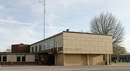
(c) I, Cburnett, CC BY-SA 3.0 Domstolsbyggnaden | |
| Motto: Proud of our history. Ready for the future. | |
| Land | |
|---|---|
| Delstat | Iowa |
| County | Clarke County |
| Höjdläge | 348 m ö.h. |
| Koordinater | 41°2′2″N 93°45′56″V / 41.03389°N 93.76556°V |
| Yta | 17,3 km² (2010) |
| - land | 16,8 km² |
| - vatten | 0,5 km² |
| Folkmängd | 4 929 (2010) |
| Befolkningstäthet | 293 invånare/km² |
| Tidszon | CST (UTC-6) |
| - sommartid | CDT (UTC-5) |
| ZIP-kod | 50213 |
| Riktnummer | 641 |
| FIPS | 1959835 |
| Geonames | 4870211 |
Ortens läge i Iowa | |
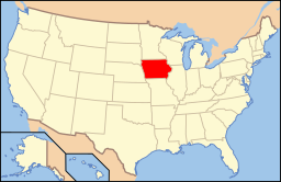
Iowas läge i USA | |
| Webbplats: osceolaia.net | |
Osceola är administrativ huvudort i Clarke County i Iowa.[1][2][3] Vid 2010 års folkräkning hade Osceola 4 929 invånare.[4]
Kända personer från Osceola
- Lloyd Thurston, politiker
Källor
- ^ Iowa County Map with County Seat Cities. Geology.com Geoscience News and Information. Läst 21 augusti 2017.
- ^ Osceola, IA. Map Quest. Läst 21 augusti 2017.
- ^ Profile for Osceola, Iowa Arkiverad 12 juni 2017 hämtat från the Wayback Machine.. ePodunk. Läst 21 augusti 2017.
- ^ 2010 Census Population of Osceola, Iowa Arkiverad 21 augusti 2017 hämtat från the Wayback Machine.. Census Viewer. Läst 21 augusti 2017.
|
Media som används på denna webbplats
Shiny red button/marker widget. Used to mark the location of something such as a tourist attraction.
(c) I, Cburnett, CC BY-SA 3.0
County courthouse for Clarke County, Iowa.
Författare/Upphovsman: This version: uploader
Base versions this one is derived from: originally created by en:User:Wapcaplet, Licens: CC BY 2.0
Map of USA with Iowa highlighted
Författare/Upphovsman: Alexrk2, Licens: CC BY 3.0
Den här Det karta skapades med GeoTools.


