Obock
| Obock | |
| أوبوك | |
| Stad | |
Obock | |
| Land | |
|---|---|
| Region | Obock |
| Höjdläge | 13 m ö.h. |
| Koordinater | 11°57′51″N 43°17′28″Ö / 11.96417°N 43.29111°Ö |
| Area | 2 km² |
| Folkmängd | 11 706 (2009-05-29)[1] |
| Tidszon | EAT (UTC+3) |
| Geonames | 221527 |
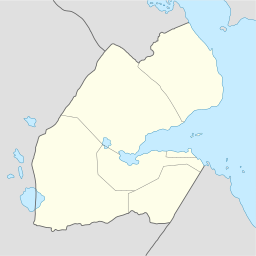
Stadens läge i Djibouti | |
Obock (arabiska: أوبوك) är en liten hamnstad i nordöstra Djibouti vid Tadjouravikens norra kust. Den är huvudstad i regionen Obock. Staden hade år 2009, 11 706 invånare.[1] Det finns färjor till staden Djibouti från Obock.
Under den europeiska kapplöpningen om Afrika förvärvade fransmännen 1862 Obock. Den användes som kolstation för fartygen utefter sjöleden genom Suezkanalen och Röda havet till Indien.[2]
Referenser
- ^ [a b] ”Djibouti: Regions, Major Cities & Towns - Population Statistics in Maps and Charts” (på engelska). www.citypopulation.de. https://www.citypopulation.de/Djibouti.html. Läst 5 september 2017.
- ^ Encyclopaedia Britannica; Somaliland
| |||||
Media som används på denna webbplats
Shiny red button/marker widget. Used to mark the location of something such as a tourist attraction.
The port of Obock, Djibouti. Quoting from the source (below): "U.S. engineers attached to the maritime engagement team from Combined Joint Task Force – Horn of Africa and Djiboutian navy engineers met with the contractors who built the pier facility for CJTF-HOA to learn about maintaining the facility’s systems."
Författare/Upphovsman: NordNordWest, Licens: CC BY-SA 3.0
Location map of Djibouti


