Oberwinterthur
| Oberwinterthur | ||
| Stadsdelsområde | ||
Oberwinterthur | ||
| ||
| Land | ||
|---|---|---|
| Kanton | Zürich | |
| Distrikt | Winterthur | |
| Krets | 2 | |
| Kommun | Winterthur | |
| Koordinater | 47°31′0″N 8°46′7″Ö / 47.51667°N 8.76861°Ö | |
| Yta | 17,57 km² | |
| Folkmängd | 24 369 (2020)[1] | |
| Befolkningstäthet | 1 387 inv./km² | |
| Tidszon | CET (UTC+1) | |
| - sommartid | CEST (UTC+2) | |
| Postnummer | 8400, 8494, 8409, 8352 | |
| Geonames | 6295536 | |
| Språk | Tyska | |
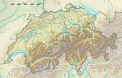
Oberwinterthurs läge i Schweiz | ||
Winterthurs indelning | ||
Oberwinterthur är ett stadsdelsområde (Stadtkreis) i kommunen Winterthur i kantonen Zürich, Schweiz.
Oberwinterthur består av stadsdelarna Talacker, Guggenbühl, Grüze, Hegmatten, Hegi, Zinzikon, Reutlingen, Stadel och Ricketwil.
Källor
- ^ ”Quartierspiegel 2020” (på tyska) (
 PDF). Stadt Winterthur. Arkiverad från originalet den 1 april 2021. https://web.archive.org/web/20210401082751/https://stadt.winterthur.ch/themen/die-stadt/winterthur/statistik/ftw-simplelayout-filelistingblock/quartierspiegel-2020/@@download/file/Quartierspiegel%202020.pdf. Läst 1 april 2021.
Media som används på denna webbplats
Författare/Upphovsman: Eric Gaba (Sting - fr:Sting) and NordNordWest, Licens: CC BY-SA 3.0
Blank physical map of Switzerland, for geo-location purpose. More maps: → Maps of Switzerland.
Shiny red button/marker widget. Used to mark the location of something such as a tourist attraction.
Författare/Upphovsman: Paebi, Licens: CC BY-SA 3.0
Old town center of Oberwinterthur ZH, Switzerland
Författare/Upphovsman: Tschubby
- Winterthur Stadtkreis 2
- Author: http://de.wikipedia.org/wiki/Benutzer:Tschubby
Coat of arms of the district Oberwinterthur of the city of Winterthur (Switzerland)


