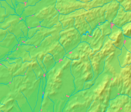
Nové Mesto nad Váhom
| Nové Mesto nad Váhom | |
| Stad | |
Nové Mesto nad Váhoms kyrka | |
| Land | |
|---|---|
| Region | Trenčín |
| Okres | Nové Mesto nad Váhom |
| Höjdläge | 195 m ö.h. |
| Koordinater | 48°45′17″N 17°49′51″Ö / 48.75472°N 17.83083°Ö |
| Area | 32,58 km² |
| Folkmängd | 20 066 (31 december 2017) |
| Befolkningstäthet | 616 invånare/km² |
| Först omtalad | 1263 |
| Borgmästare | Jozef Trstenský |
| Postnummer | 915 01 |
| Riktnummer | +421-32 |
| Registreringsskylt | NM |
| Geonames | 3058477 |
Nové Mesto nad Váhom markerat på en karta över Slovakien | |
Nové Mesto nad Váhom markerat på en karta över regionen Trenčín | |
| Webbplats: www.nove-mesto.sk | |
Nové Mesto nad Váhom är en stad i distriktet Nové Mesto nad Váhom i regionen Trenčín i västra Slovakien.
Geografi
Staden ligger på 195 meters höjd och har en area på 32,58 km². Den har ungefär 20 100 invånare (2017).
Referenser
- Den här artikeln är helt eller delvis baserad på material från slovakiskspråkiga Wikipedia, Nové Mesto nad Váhom, 6 mars 2019.
Externa länkar
 Wikimedia Commons har media som rör Nové Mesto nad Váhom.
- Nové Mesto nad Váhom officiella webbplats
Media som används på denna webbplats
Shiny red button/marker widget. Used to mark the location of something such as a tourist attraction.
Författare/Upphovsman: Caroig, Licens: CC BY-SA 3.0
Outline map of the Trenčín Region, Slovakia, ready for the Geobox template, calibrated at en:Template:Geobox locator Trenčín Region
Författare/Upphovsman: Caroig, Licens: CC BY-SA 3.0
Outline map of Slovakia, ready for the Geobox template, calibrated at en:Template:Geobox locator Slovakia
Background map of Slovakia, ready for the Geobox template, calibrated at en:Template:Geobox locator Slovakia
Författare/Upphovsman: LMih, Licens: CC BY-SA 3.0
This media shows the protected monument with the number 304-1277/2 (other) in the Slovak Republic.
Background map of the Trenčín Region, Slovakia, ready for the Geobox template, calibrated at en:Template:Geobox locator Trenčín Region


