Nikkō
| Nikkō (日光市) | |
| Stad | |
| Land | |
|---|---|
| Region | Kantō |
| Prefektur | Tochigi |
| Ö | Honshū |
| Koordinater | 36°45′N 139°36′Ö / 36.750°N 139.600°Ö |
| Area | 1 449,83 km²[1] |
| Folkmängd | 83 446 (1 okt 2015)[1] |
| Befolkningstäthet | 58 invånare/km² |
| Borgmästare | no value (2021–) |
| Geonames | 1855395 |
| Träd | Lönnsläktet[2] och Manchurisk björk[2] |
| Fågel | Kungsfiskare[2] och japansk cettia[2] |
| Blomma | Hemerocallis esculenta[2] och Yashioazalea[2] |
| Fisk | Indianlax[2] och Rödingar[2] |
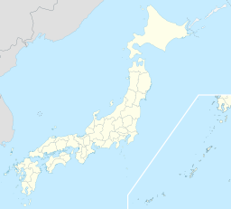
Nikkōs läge i Japan | |
Nikkōs läge i prefekturen Tochigi | |
| Webbplats: http://www.city.nikko.lg.jp | |
Nikkō (日光市, Nikkō-shi) är en bergsbelägen stad i Tochigi prefektur på huvudön Honshu i Japan. Nikkō betyder solljus på japanska. Nikkō fick stadsrättigheter 1 februari 1954,[1] och stadens nuvarande område bildades 20 mars 2006 genom en sammanslagning av de två städerna Nikkō och Imaichi, de två köpingarna Fujihara och Ashio samt byn Kuriyama.[3]
Världsarv
Helgedomar och tempel i Nikko är ett världsarv på Unescos världsarvslista beläget i Nikkō. Det omfattar shintohelgedomarna Futarasan och Tōshō-gū. samt det buddhistiska templet Rinnō-ji. Det togs upp på listan 1999.[4]
Galleri
- (c) User: Bgabel at wikivoyage shared, CC BY-SA 3.0
Tre aporna, Tōshō-gū
Källor
- ^ [a b c] ”Japansk sida med invånarantal och ytor”. Masahiro Higashide. http://uub.jp/cpf/tochigi.html. Läst 24 september 2016.
- ^ [a b c d e f g h] läs online, www.city.nikko.lg.jp.[källa från Wikidata]
- ^ ”Location, Topography & History of Nikko City”. Nikkō stad. Arkiverad från originalet den 27 maj 2007. https://web.archive.org/web/20070527015215/http://www.city.nikko.lg.jp/fl/english/introduction/cityinfo.html. Läst 27 juli 2009.
- ^ ”Summary of "Shrines and Temples of Nikko"”. Nikkō stad. Arkiverad från originalet den 30 mars 2010. https://web.archive.org/web/20100330144608/http://www.city.nikko.lg.jp/kankou/shaji/english/regist/summ.htm. Läst 27 juli 2009.
Media som används på denna webbplats
Författare/Upphovsman: Maximilian Dörrbecker (Chumwa), Licens: CC BY-SA 3.0
Location map of Japan
Equirectangular projection.
Geographic limits to locate objects in the main map with the main islands:
- N: 45°51'37" N (45.86°N)
- S: 30°01'13" N (30.02°N)
- W: 128°14'24" E (128.24°E)
- E: 149°16'13" E (149.27°E)
Geographic limits to locate objects in the side map with the Ryukyu Islands:
- N: 39°32'25" N (39.54°N)
- S: 23°42'36" N (23.71°N)
- W: 110°25'49" E (110.43°E)
- E: 131°26'25" E (131.44°E)
Shiny red button/marker widget. Used to mark the location of something such as a tourist attraction.
(c) User: Bgabel at wikivoyage shared, CC BY-SA 3.0
Die 3 Affen (nichts Böses hören, nichts Böses sagen, nichts Böses sehen) am heiligen Stall im Tosho-gu
Författare/Upphovsman: そらみみ, Licens: CC BY-SA 3.0
輪王寺・金堂前の展望
This photograph shows a building (probably the haiden 拝殿) at Futarasan Jinja 二荒山神社 in Nikko, Tochigi Prefecture, Japan. I took the photograph and contribute my rights in the file to the public domain; individuals and organizations retain rights to images in it.
Författare/Upphovsman: Nerotaso, Licens: CC BY-SA 3.0
Toshogu shrine, Nikko, Japan
Författare/Upphovsman: Lincun from Japanese Wikipedia, Licens: CC BY-SA 3.0
Location of Nikkō city in Tochigi Prefecture, Japan


