New Georgia Sound
not parsed now - please come back in a few minutesMedia som används på denna webbplats
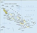
Solomon Islands map, modified and cropped from PCL map collection Courtesy of the University of Texas Libraries, The University of Texas at Austin.
According to the University of Texas, "most of the maps scanned by the University of Texas Libraries and served from this web site are in the public domain. No permissions are needed to copy them. You may download them and use them as you wish. A few maps are copyrighted, and are clearly marked as such.". As the image, when downloaded from here was no tagged, the map is PD.
For a small map of the Solomon Islands, see: Image:SolomonIslandsMap.png
Note that provincial borders are pre-1995; Rennell and Bellona has separated from Central Province, and Choiseul Province has separated from Western Province.
Originally uploaded to En-Wikipedia by Darwinek on 13:39, 29 December 2004.