Navis
| Navis | ||
| Kommun | ||
(c) Piergiuliano Chesi, CC BY-SA 3.0 Navis | ||
| ||
| Land | ||
|---|---|---|
| Förbundsland | Tyrolen | |
| Distrikt | Innsbruck-Land | |
| Höjdläge | 1 337 m ö.h. | |
| Koordinater | 47°07′52″N 11°32′25″Ö / 47.13111°N 11.54028°Ö | |
| Area | 64,13 km²[1] | |
| Folkmängd | 2 054 (1 januari 2024)[2] | |
| Befolkningstäthet | 32 invånare/km² | |
| Borgmästare | Lukas Peer (Navis – Inser Dahoam) | |
| Tidszon | CET (UTC+1) | |
| - sommartid | CEST (UTC+2) | |
| Postnummer | 6145 | |
| Riktnummer | 05278 | |
| Kommunkod | 7 03 33 | |
| Geonames | 2770909 | |
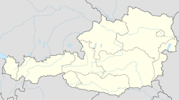
(c) Karte: NordNordWest, Lizenz: Creative Commons by-sa-3.0 de Läge i Österrike | ||
Kommunens läge i distriktet Innsbruck-Land | ||
| Webbplats: www.navis.tirol.gv.at | ||
Navis är en ort och kommun i distriktet Innsbruck-Land i förbundslandet Tyrolen i Österrike. Kommunen ligger 19 km sydost om Tyrolens huvudstad Innsbruck. Den har 2 054 invånare (2024) och består av tre orter (Ortschaften) (inom parentes invånarantal 1 januari 2024)[3]:
- Außerweg (1 014)
- Oberweg (671)
- Unterweg (369)
Referenser
- ^ ”Gemeindeverzeichnis 2024” (på tyska) (.ods). Statistik Austria. https://www.statistik.at/fileadmin/pages/453/RegGemVz2024.ods. Läst 20 augusti 2024.
- ^ ”Bevölkerung zu Jahresbeginn nach administrativen Gebietseinheiten (Bundesländer, NUTS-Regionen, Bezirke, Gemeinden) seit 2002” (på tyska) (.ods). Statistik Austria. https://www.statistik.at/fileadmin/pages/405/Bev_Zeitreihe_Jahresbeginn_Gebietseinheiten_2024.ods. Läst 20 augusti 2024.
- ^ ”Bevölkerung am 01.01.2024 nach Ortschaften (Gebietsstand 01.01.2024)” (på tyska) (.ods). Statistik Austria. https://www.statistik.at/fileadmin/pages/405/Bev_Ortschaften_2024.ods. Läst 20 augusti 2024.
Externa länkar
 Wikimedia Commons har media som rör Navis.
- Officiell webbplats
| |||||||
Media som används på denna webbplats
Shiny red button/marker widget. Used to mark the location of something such as a tourist attraction.
Författare/Upphovsman: Joschi Täubler, Licens: CC BY-SA 3.0
District Innsbruck Land
This image is in the public domain according to Austrian copyright law because it is part of a law, ordinance or official decree issued by an Austrian federal or state authority, or because it is of predominantly official use. (§7 UrhG)
To uploader: Please provide where the image was first published and who created it.
(c) Piergiuliano Chesi, CC BY-SA 3.0
(c) Karte: NordNordWest, Lizenz: Creative Commons by-sa-3.0 de
Location map of Austria


