Naugatuck
| Naugatuck | |
| borough | |
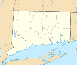
Lägeskarta | |
| Land | |
|---|---|
| Delstat | Connecticut |
| County | New Haven County |
| Koordinater | 41°29′18″N 73°3′6″V / 41.48833°N 73.05167°V |
| Yta | 42,5 km² (2010)[1] |
| - land | 42,2 km² |
| - vatten | 0,2 km² |
| Folkmängd | 31 862 (2010)[2] |
| Befolkningstäthet | 755 invånare/km² |
| Tidszon | EST (UTC-5) |
| - sommartid | EDT (UTC-4) |
| ZIP-kod | 06770[3] |
| FIPS | 0949880 |
| Geonames | 4839222 |
Ortens läge i Connecticut | |
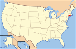
Connecticuts läge i USA | |
Naugatuck är en kommun (town) i New Haven County i delstaten Connecticut, USA med cirka 30 989 invånare (2000). Den har enligt United States Census Bureau en area på totalt 42,7 km² varav 0,2 km² är vatten.
Källor
- ^ ”2010 Census Gazetteer Files”. US Census Bureau. Arkiverad från originalet den 14 juli 2012. https://www.webcitation.org/699nOulzi?url=http://www.census.gov/geo/www/gazetteer/files/Gaz_places_national.txt. Läst 14 juli 2012.
- ^ ”Naugatuck (borough), Connecticut” (på engelska). State & County Quickfacts. U.S. Census Bureau,. Arkiverad från originalet den 20 juni 2012. https://www.webcitation.org/68ZHSqfbm?url=http://quickfacts.census.gov/qfd/states/09/0949880.html. Läst 20 juni 2012.
- ^ ”2010 ZIP Code Tabulation Area (ZCTA) Relationship Files”. U.S. Census Bureau. 29 december 2010. Arkiverad från originalet den 25 augusti 2012. https://www.webcitation.org/6ABdwXxbq?url=http://www.census.gov/geo/www/2010census/zcta_rel/zcta_place_rel_10.txt. Läst 25 augusti 2012.
| ||||||||||
Media som används på denna webbplats
Shiny red button/marker widget. Used to mark the location of something such as a tourist attraction.
Författare/Upphovsman: Alexrk2, Licens: CC BY 3.0
Den här Det karta skapades med GeoTools.
Författare/Upphovsman: This version: uploader
Base versions this one is derived from: originally created by en:User:Wapcaplet, Licens: CC BY 2.0
Map of USA with Connecticut highlighted


