Nandewar Range
| Den här artikeln har skapats av Lsjbot, ett program (en robot) för automatisk redigering. (2015-12) Artikeln kan innehålla fakta- eller språkfel, eller ett märkligt urval av fakta, källor eller bilder. Mallen kan avlägsnas efter en kontroll av innehållet (vidare information) |
| Nandewar Range | |
| Bergskedja | |
| Land | |
|---|---|
| Delstat | New South Wales |
| Höjdläge | 857 m ö.h. |
| Koordinater | 30°21′10″S 150°14′05″Ö / 30.35286°S 150.23472°Ö |
| Högsta punkt | |
| - koordinater | 30°18′52″S 150°06′56″Ö / 30.31452667°S 150.1155533°Ö |
| Längd | 81 km (sydostlig-nordvästlig) |
| Tidszon | AEST (UTC+10) |
| - sommartid | AEDT (UTC+11) |
| Geonames | 2155838 |
Nandewar Range är en bergskedja i Australien.[1] Den ligger i delstaten New South Wales, i den sydöstra delen av landet, omkring 400 kilometer norr om delstatshuvudstaden Sydney.
Nandewar Range sträcker sig 81 km i sydostlig-nordvästlig riktning.[a]
Topografiskt ingår följande toppar i Nandewar Range:
- Black Mountain
- Bobbiwaa Peak
- Bradys Downfall
- Brushy Mountain
- Castle Rock
- Cayaldi Mountain
- Corrunbral Borawah
- Deriah Mountain
- Doyles Peak
- Flaggy Mountain
- Gins Mountain
- Governor Mountain
- Grattai Mountain
- Lagoon Mountain
- Lowes Mountain
- Mount Abbotsmith
- Mount Byar
- Mount Capel
- Mount Coryah
- Mount Dowe
- Mount Forbes
- Mount Hook
- Mount Kapunda
- Mount Kaputar
- Mount Lawler
- Mount Lindesay
- Mount Lindsay
- Mount Mitchell
- Mount Plagyan
- Mount Waa
- Ningadhun
- Pound Mountain
- Round Mountain
- Sinclair Peak
- Snake Mountain
- Split Yard Mountain
- Square Mountain
- The Bishops Cap
- Waterloo Pinnacle
- Yulludunida
I omgivningarna runt Nandewar Range växer huvudsakligen savannskog.[3] Trakten runt Nandewar Range är nära nog obefolkad, med mindre än två invånare per kvadratkilometer.[4] Genomsnittlig årsnederbörd är 762 millimeter. Den regnigaste månaden är januari, med i genomsnitt 126 mm nederbörd, och den torraste är oktober, med 18 mm nederbörd.[5]
Kommentarer
Källor
- ^ Nandewar Range hos GeoNames.Org (cc-by); post uppdaterad 2013-10-06; databasdump nerladdad 2015-12-01
- ^ ”Viewfinder Panoramas Digital elevation Model”. http://www.viewfinderpanoramas.org/dem3.html. Läst 21 juni 2015.
- ^ ”NASA Earth Observations: Land Cover Classification”. NASA/MODIS. Arkiverad från originalet den 28 februari 2016. https://web.archive.org/web/20160228161657/http://neo.sci.gsfc.nasa.gov/view.php?datasetId=MCD12C1_T1. Läst 30 januari 2016.
- ^ ”NASA Earth Observations: Population Density”. NASA/SEDAC. Arkiverad från originalet den 9 februari 2016. https://web.archive.org/web/20160209064446/http://neo.sci.gsfc.nasa.gov/view.php?datasetId=SEDAC_POP. Läst 30 januari 2016.
- ^ ”NASA Earth Observations: Rainfall (1 month - TRMM)”. NASA/Tropical Rainfall Monitoring Mission. Arkiverad från originalet den 11 maj 2020. https://web.archive.org/web/20200511075534/https://neo.sci.gsfc.nasa.gov/view.php?datasetId=TRMM_3B43M. Läst 30 januari 2016.
Media som används på denna webbplats
Robot icon
Författare/Upphovsman: , Licens: CC BY-SA 3.0
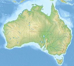
Relief map of Australia, including the borders of the states of the Commonwealth of Australia
Shiny red button/marker widget. Used to mark the location of something such as a tourist attraction.
Just north of Narrabri, New South Wales. Photo of Nandewar Range from Newell Highway. Mount Kaputar, the third peak from the left, is the range's highest peak.


