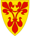
Nærøysunds kommun
| Nærøysunds kommun | ||
| Nærøysund kommue | ||
| Kommun | ||
| Land | ||
|---|---|---|
| Fylke | Trøndelag fylke | |
| Koordinater | 64°50′21″N 11°27′39″Ö / 64.83917°N 11.46083°Ö | |
| Centralort | Kolvereid och Rørvik | |
| Area | 4 777,52 km² (2020)[2] | |
| - land | 1 286,31 km² (2020) | |
| - vatten | 59,85 km² | |
| Folkmängd | 9 890 (2023)[3] | |
| Befolkningstäthet | 8 invånare/km² | |
| Grundad | 1 januari 2020[1] | |
| - Ersätter | Nærøy kommun (2020) Vikna (2020) | |
| Politik | ||
| - Kommunstyrelsens ordförande | Amund Hellesø (2020–) | |
| Tidszon | CET (UTC+1) | |
| - sommartid | CEST (UTC+2) | |
| Kommunkod | 5060 | |
| Geonames | 12110626 | |
 Nærøysunds kommun i Trøndelag fylke. | ||
(c) Karte: NordNordWest, Lizenz: Creative Commons by-sa-3.0 de Trøndelag fylke i Norge. | ||
| Wikimedia Commons: Nærøysund | ||
| Webbplats: https://www.naroysund.kommune.no/ | ||
| Redigera Wikidata | ||
Nærøysunds kommun (norska: Nærøysund kommue) är en kommun i Trøndelag fylke i mellersta Norge. Kommunens centralorter är de båda städerna Rørvik och Kolvereid.
Angränsande kommuner är Leka i norr, Bindal (i Nordland fylke) i nordöst, Høylandet i öster och Namsos i söder. Kommunen har även maritim gräns med Flatangers kommun i sydväst.[4]
Administrativ historik
Nærøysunds kommun etablerades den 1 januari 2020 genom en hopslagning av Vikna kommun och huvuddelen av Nærøy kommun.[5] [6]
Vapen för tidigare kommuner inom den nuvarande kommunen
- Nærøy kommun
(1987–2019) - Vikna kommun
(1988–2019)
Tätorter
I Nærøysunds kommun finns tre tätorter:[7]
Socknar
Inom Norska kyrkan är Nærøysunds kommun indelad i två socknar:[8]
- Nærøy socken
- Vikna socken
Socknarna ingår i Namdals prosteri i Nidaros stift.[9]
Källor
- ^ Forskrift om sammenslåing av Nærøy kommune og Vikna kommune til Nærøysund kommune, Trøndelag, läs onlineläs online.[källa från Wikidata]
- ^ Statens kartverk, Arealstatistikk for Norge 2020, Statens kartverk, 20 december 2019, läs online.[källa från Wikidata]
- ^ 07459: Alders- og kjønnsfordeling i kommuner, fylker og hele landets befolkning (K) 1986 - 2023 (på norskt bokmål), Statistisk sentralbyrå, 21 februari 2023, läs online.[källa från Wikidata]
- ^ Norgeskart.no
- ^ ”Forskrift om sammenslåing av Nærøy kommune og Vikna kommune til Nærøysund kommune, Trøndelag” (på norska). https://lovdata.no/dokument/LF/forskrift/2018-04-30-660/§7#§7. Läst 2 september 2020.
- ^ ”En rekke regionendringer ble iverksatt 1.1.2020” (på norska). https://www.ssb.no/offentlig-sektor/kommunekatalog/endringer-i-de-regionale-inndelingene#Alle_kommuneendringer_18382017. Läst 1 september 2020.
- ^ ”Tettsteders befolkning og areal”. Statistisk sentralbyrå. 12 december 2023. https://www.ssb.no/befolkning/folketall/statistikk/tettsteders-befolkning-og-areal.
- ^ Sokn og kirkebygg i Den norske kirke
- ^ Store norske leksikon
Externa länkar
- Officiell webbplats
 Wikimedia Commons har media som rör Nærøysunds kommun.
| ||||||||||
Media som används på denna webbplats
Författare/Upphovsman: Gutten på Hemsen, Licens: CC0
Flag of Norway with colors from the previous version on Commons. This file is used to discuss the colors of the Norwegian flag.
Coat of arms for Nord-Trøndelag; until 31 December 2017 county (fylke), Norway
Författare/Upphovsman: Jay1279, Licens: CC0
Map of Nærøysund municipality in Trøndelag county, Norway (created in 2020 by a merger of municipalities)
Coat of arms for the municipality of Vikna (kommune), Norway The coat-of-arms is from modern times. They were granted on 13 May 1988. The arms show three salmon on a blue background. This was chosen because salmon fishing and farming was (and still is) an important source of income in the municipality.
(c) Karte: NordNordWest, Lizenz: Creative Commons by-sa-3.0 de
Location of county Trøndelag in Norway (2024)
Författare/Upphovsman: Erik Fløan, Licens: CC BY-SA 4.0
Collage med motiver fra Nærøysund kommune (fra 2020) (nå Nærøy og Vikna kommuner).
Coat of arms for the municipality of Nærøy (kommune), Norway The coat-of-arms is from modern times. They were granted on 22 May 1987. The arms are based on the seal of King Håkon Magnusson from 1344, on a document in which the King granted several rights to the local farmers. The seal shows the St. Mary in a portal decorated with fleur-de-lis, the symbol of the St. Mary. The arms show a combination of three fleur-de-lis, the colour was chosen as red, as the local water lilies generally have a red color.
Författare/Upphovsman: Jay1279, Licens: CC0
Coat of arms of Nærøysund municipality in Trøndelag, Norway


