Município Sumbe
| Den här artikeln har skapats av Lsjbot, ett program (en robot) för automatisk redigering. (2015-11) Artikeln kan innehålla fakta- eller språkfel, eller ett märkligt urval av fakta, källor eller bilder. Mallen kan avlägsnas efter en kontroll av innehållet (vidare information) |
| Município Sumbe | |
| Sumbe, Concelho de Novo Redondo | |
| Kommun | |
| Land | |
|---|---|
| Provins | Cuanza Sul |
| Höjdläge | 157 m ö.h. |
| Koordinater | 11°26′49″S 13°56′09″Ö / 11.44707°S 13.93584°Ö |
| Tidszon | WAT (UTC+1) |
| Geonames | 3346014 |
Município Sumbe är en kommun i Angola.[1] Den ligger i provinsen Cuanza Sul, i den västra delen av landet, 300 km söder om huvudstaden Luanda.
I omgivningarna runt Município Sumbe växer huvudsakligen savannskog.[2] Runt Município Sumbe är det glesbefolkat, med 17 invånare per kvadratkilometer.[3]
Källor
- ^ Sumbe at GeoNames.Org (cc-by); post uppdaterad 2015-08-06; databasdump nerladdad 2015-11-07
- ^ ”NASA Earth Observations: Land Cover Classification”. NASA/MODIS. Arkiverad från originalet den 28 februari 2016. https://web.archive.org/web/20160228161657/http://neo.sci.gsfc.nasa.gov/view.php?datasetId=MCD12C1_T1. Läst 30 januari 2016.
- ^ ”NASA Earth Observations: Population Density”. NASA/SEDAC. Arkiverad från originalet den 9 februari 2016. https://web.archive.org/web/20160209064446/http://neo.sci.gsfc.nasa.gov/view.php?datasetId=SEDAC_POP. Läst 30 januari 2016.
Media som används på denna webbplats
Robot icon
Shiny red button/marker widget. Used to mark the location of something such as a tourist attraction.
Författare/Upphovsman: Uwe Dedering, Licens: CC BY-SA 3.0
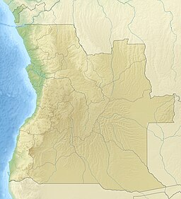
Relief location map of Angola.
- Projection: Equirectangular projection, strechted by 102.0%.
- Geographic limits of the map:
- N: -4.1° N
- S: -18.5° N
- W: 11.1° E
- E: 24.5° E
- GMT projection: -JX21.4376cd/23.498169313432836cd
- GMT region: -R11.1/-18.5/24.5/-4.1r
- GMT region for grdcut: -R11.1/-18.5/24.5/-4.1r
- Relief: SRTM30plus.
- Made with Natural Earth. Free vector and raster map data @ naturalearthdata.com.


