Mount Dendi
| Den här artikeln har skapats av Lsjbot, ett program (en robot) för automatisk redigering. (2016-04) Artikeln kan innehålla fakta- eller språkfel, eller ett märkligt urval av fakta, källor eller bilder. Mallen kan avlägsnas efter en kontroll av innehållet (vidare information) |
| Mount Dendi | |
| Caldera | |
| Land | |
|---|---|
| Region | Oromia |
| Höjdläge | 3 260 m ö.h. |
| Koordinater | 8°50′15″N 38°01′09″Ö / 8.83741°N 38.01922°Ö |
| Tidszon | EAT (UTC+3) |
| Geonames | 339400 |
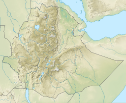
(c) Karte: NordNordWest, Lizenz: Creative Commons by-sa-3.0 de Läge i Etiopien | |
Mount Dendi är en caldera i Etiopien.[1] Den ligger i regionen Oromia, i den centrala delen av landet, 80 km väster om huvudstaden Addis Abeba. Toppen på Mount Dendi är 3 260 meter över havet.[1]
Terrängen runt Mount Dendi är huvudsakligen kuperad, men den allra närmaste omgivningen är platt.[a] Den högsta punkten i närheten är 3 369 meter över havet, 16,2 km väster om Mount Dendi.[b] Runt Mount Dendi är det ganska tätbefolkat, med 230 invånare per kvadratkilometer.[3] Omgivningarna runt Mount Dendi är en mosaik av jordbruksmark och naturlig växtlighet.[4]
Ett tropiskt höglandsklimat råder i trakten.[5] Årsmedeltemperaturen i trakten är 15 °C. Den varmaste månaden är februari, då medeltemperaturen är 18 °C, och den kallaste är juli, med 12 °C.[6] Genomsnittlig årsnederbörd är 1 119 millimeter. Den regnigaste månaden är juli, med i genomsnitt 234 mm nederbörd, och den torraste är december, med 3 mm nederbörd.[7]
| Mount Dendi | ||||||||||||||||||||||||||||||||||||||||||||||||||||||||||||
|---|---|---|---|---|---|---|---|---|---|---|---|---|---|---|---|---|---|---|---|---|---|---|---|---|---|---|---|---|---|---|---|---|---|---|---|---|---|---|---|---|---|---|---|---|---|---|---|---|---|---|---|---|---|---|---|---|---|---|---|---|
| Klimatdiagram (förklaring) | ||||||||||||||||||||||||||||||||||||||||||||||||||||||||||||
| ||||||||||||||||||||||||||||||||||||||||||||||||||||||||||||
Kommentarer
Källor
- ^ [a b] Mount Dendi hos Geonames.org (cc-by); post uppdaterad 2014-12-30; databasdump nerladdad 2016-04-24
- ^ [a b] ”Viewfinder Panoramas Digital elevation Model”. http://www.viewfinderpanoramas.org/dem3.html. Läst 21 juni 2015.
- ^ ”NASA Earth Observations: Population Density”. NASA/SEDAC. Arkiverad från originalet den 9 februari 2016. https://web.archive.org/web/20160209064446/http://neo.sci.gsfc.nasa.gov/view.php?datasetId=SEDAC_POP. Läst 30 januari 2016.
- ^ ”NASA Earth Observations: Land Cover Classification”. NASA/MODIS. Arkiverad från originalet den 28 februari 2016. https://web.archive.org/web/20160228161657/http://neo.sci.gsfc.nasa.gov/view.php?datasetId=MCD12C1_T1. Läst 30 januari 2016.
- ^ Peel, M C; Finlayson, B L; McMahon, T A (2007). ”Updated world map of the Köppen-Geiger climate classification”. Hydrology and Earth System Sciences 11: sid. 1633-1644. doi:. http://www.hydrol-earth-syst-sci.net/11/1633/2007/hess-11-1633-2007.html. Läst 30 januari 2016.
- ^ [a b] ”NASA Earth Observations Data Set Index”. NASA. Arkiverad från originalet den 28 november 2017. https://web.archive.org/web/20171128214629/https://neo.sci.gsfc.nasa.gov/dataset_index.php. Läst 30 januari 2016.
- ^ ”NASA Earth Observations: Rainfall (1 month - TRMM)”. NASA/Tropical Rainfall Monitoring Mission. Arkiverad från originalet den 19 april 2019. https://web.archive.org/web/20190419091014/https://neo.sci.gsfc.nasa.gov/view.php?datasetId=TRMM_3B43M&year=2014. Läst 30 januari 2016.
Media som används på denna webbplats
Robot icon
Shiny red button/marker widget. Used to mark the location of something such as a tourist attraction.
(c) Karte: NordNordWest, Lizenz: Creative Commons by-sa-3.0 de
Location map of Ethiopia
Dendi Caldera, Ethiopia is featured in this image photographed by an Expedition 16 crew member on the International Space Station. The Dendi Caldera is located on the Ethiopian Plateau, approximately 86 kilometers to the southwest of Addis Ababa. A caldera is a geological feature formed by the near-total eruption of magma from beneath a volcano, leading to collapse of the volcanic structure into the now-empty magma chamber. This collapse typically leaves a crater or depression where the volcano stood, and later volcanic activity can fill the caldera with younger lavas, ash, pyroclastic rocks, and sediments. While much of the volcanic rock in the area is comprised of basalt erupted as part of the opening of the East African Rift, more silica-rich rock types (characterized by minerals such as quartz and feldspar) are also present. According to scientists, the approximately 4 kilometers wide Dendi Caldera includes some of this silica-rich volcanic rock -- the rim of the caldera, visible in this view, is comprised mainly of poorly-consolidated ash erupted during the Tertiary Period (approximately 65 -- 2 million years ago). A notable feature of the Dendi Caldera is the presence of two shallow lakes formed within the central depression (center). This image also highlights a radial drainage pattern surrounding the remnants of the Dendi volcanic cone. Such patterns typically form around volcanoes, as rainfall has equal potential to move downslope on all sides of the cone and incise channels. No historical volcanic eruptions of Dendi are recorded, however the Wonchi Caldera 13 kilometers to the southwest (not shown) may have been active as "recently" as A.D. 550, say NASA scientists.


