Monticello, Indiana
| Monticello | |
| city | |
Monticello Carnegie Library | |
| Land | |
|---|---|
| Delstat | Indiana |
| County | White County |
| Koordinater | 40°44′42″N 86°46′2″V / 40.74500°N 86.76722°V |
| Yta | 9,5 km² (2010)[1] |
| - land | 9 km² |
| - vatten | 0,6 km² |
| Folkmängd | 5 378 (2010)[2] |
| Befolkningstäthet | 598 invånare/km² |
| Tidszon | EST (UTC-5) |
| - sommartid | EDT (UTC-4) |
| ZIP-kod | 47960[3] |
| FIPS | 1850760 |
| Geonames | 4923745 |
Ortens läge i Indiana | |
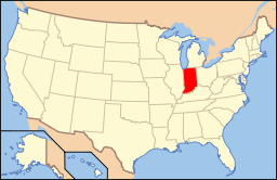
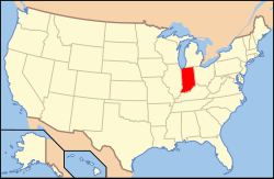
Indianas läge i USA | |
| Webbplats: http://www.monticelloin.gov/ | |
Monticello är en stad (city) i den amerikanska delstaten Indiana med en yta av 7,8 km² och en folkmängd, som uppgår till 5 723 invånare (2000). Monticello är administrativ huvudort i White County.
Kända personer från Monticello
- DJ Ashba, gitarrist och låtskrivare
- Charles S. Hartman, politiker
Källor
- ^ ”2010 Census Gazetteer Files”. US Census Bureau. Arkiverad från originalet den 14 juli 2012. https://www.webcitation.org/699nOulzi?url=http://www.census.gov/geo/www/gazetteer/files/Gaz_places_national.txt. Läst 14 juli 2012.
- ^ ”Monticello (city), Indiana” (på engelska). State & County Quickfacts. U.S. Census Bureau,. Arkiverad från originalet den 6 augusti 2012. https://www.webcitation.org/69i8iCJ3b?url=http://quickfacts.census.gov/qfd/states/18/1850760.html. Läst 6 augusti 2012.
- ^ ”2010 ZIP Code Tabulation Area (ZCTA) Relationship Files”. U.S. Census Bureau. 16 september 2010. Arkiverad från originalet den 25 augusti 2012. https://www.webcitation.org/6ABdwXxbq?url=http://www.census.gov/geo/www/2010census/zcta_rel/zcta_place_rel_10.txt. Läst 25 augusti 2012.
Externa länkar
 Wikimedia Commons har media som rör Monticello, Indiana.
- Monticello Herald Journal
|
Media som används på denna webbplats
Författare/Upphovsman: Alexrk2, Licens: CC BY 3.0
Den här Det karta skapades med GeoTools.
Shiny red button/marker widget. Used to mark the location of something such as a tourist attraction.
Författare/Upphovsman: This version: uploader
Base versions this one is derived from: originally created by en:User:Wapcaplet, Licens: CC BY 2.0
Map of USA with Indiana highlighted
Front and northern side of the Monticello Carnegie Library, located at 101 S. Bluff Street in Monticello, Indiana, United States. Built in 1907, it is now the White County Historical Museum, and it is listed on the National Register of Historic Places.


