Monticello, Florida
| Monticello | |
| city | |
| Land | |
|---|---|
| Delstat | Florida |
| County | Jefferson County |
| Koordinater | 30°32′41″N 83°52′2″V / 30.54472°N 83.86722°V |
| Yta | 8,8 km² (2010) |
| - land | 8,8 km² |
| - vatten | 0,0 km² |
| Folkmängd | 2 533 (2010) |
| Befolkningstäthet | 288 invånare/km² |
| Tidszon | EST (UTC-5) |
| - sommartid | EDT (UTC-4) |
| ZIP-kod | 32344, 32345 |
| FIPS | 1246500 |
| Geonames | 4164803 |
Ortens läge i Florida | |
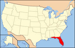
Floridas läge i USA | |
| Webbplats: http://www.cityofmonticello.us | |
Monticello är administrativ huvudort i Jefferson County i den amerikanska delstaten Florida. Orten har fått sitt namn efter Thomas Jeffersons herrgård Monticello.[1] Countyt grundades 1827 och Robison's Post Office utsågs till huvudort. Ortnamnet ändrades sedan till Monticello.[2]
Källor
- ^ Profile for Monticello, Florida Arkiverad 14 februari 2016 hämtat från the Wayback Machine.. ePodunk. Läst 8 februari 2016.
- ^ A Brief History. Jefferson County, Florida. Läst 8 februari 2016.
Media som används på denna webbplats
Författare/Upphovsman: This version: en:User:Huebi
Base versions this one is derived from: originally created by en:User:Wapcaplet, Licens: CC BY 2.0
Map of USA with Florida highlighted
Författare/Upphovsman: Seth Ilys på engelska Wikipedia, Licens: CC BY-SA 3.0
Författare/Upphovsman: Michael Rivera, Licens: CC BY-SA 3.0
Monticello City Hall, 245 S Mulberry St, Monticello, Jefferson County, Florida


