Monthey (distrikt)
| District de Monthey | |
| Distrikt | |
| Land | |
|---|---|
| Kanton | Valais |
| Koordinater | 46°15′N 6°57′Ö / 46.25°N 6.95°Ö |
| Huvudort | Monthey |
| Area | 256,79 km² |
| Folkmängd | 47 039 (2018-12-31) |
| Befolkningstäthet | 183 invånare/km² |
| Tidszon | CET (UTC+1) |
| - sommartid | CEST (UTC+2) |
| Geonames | 6458845 |
District de Monthey är ett av de 14 distrikten i kantonen Valais i Schweiz. Distriktet ligger i den franskspråkiga delen av kantonen.
Indelning
Distriktet består av nio kommuner:
| Vapen | Namn | Invånare 2021-12-31[1] | Yta i km² [2] |
|---|---|---|---|
| Champéry | 1 361 | 38,85 | |
| Collombey-Muraz | 9 676 | 29,75 | |
| Monthey | 18 096 | 28,70 | |
| Port-Valais | 4 403 | 14,35 | |
| Saint-Gingolph | 984 | 14,45 | |
| Troistorrents | 4 813 | 36,96 | |
| Val-d'Illiez | 2 119 | 39,27 | |
| Vionnaz | 2 805 | 20,95 | |
| Vouvry | 4 379 | 33,51 |
Källor
- ^ ”Bilanz der ständigen Wohnbevölkerung nach Bezirken und Gemeinden, 1991-2021” (på tyska/franska/italienska). Bundesamt für Statistik. 25 augusti 2022. https://dam-api.bfs.admin.ch/hub/api/dam/assets/23064893/master.
- ^ Arealstatistik Standard – Gemeinden nach vier Hauptbereichen (15.12.2017) des Bundesamts für Statistik BFS
Media som används på denna webbplats
Shiny red button/marker widget. Used to mark the location of something such as a tourist attraction.
Författare/Upphovsman: Eric Gaba (Sting - fr:Sting) and NordNordWest, Licens: CC BY-SA 3.0
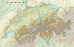
Blank physical map of Switzerland, for geo-location purpose. More maps: → Maps of Switzerland.
Författare/Upphovsman: Tschubby, Licens: CC BY-SA 3.0
Municipalities in the district of Monthey


