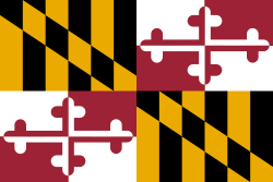
Montgomery County, Maryland
| Montgomery County | |||
| County | |||
| |||
| Land | |||
|---|---|---|---|
| Delstat | |||
| Huvudort | Rockville | ||
| Area | 1 313 km² (2010)[1] | ||
| - land | 1 272 km² (97%) | ||
| - vatten | 40,6 km² (3%) | ||
| Folkmängd | 971 777 (2010)[2] | ||
| Befolkningstäthet | 764 invånare/km² | ||
| Grundat | 1776 | ||
| - uppkallat efter | Richard Montgomery | ||
| Tidszon | EST (UTC-5) | ||
| - sommartid | EDT (UTC-4) | ||
| FIPS-kod | 24031 | ||
| Geonames | 4362716 | ||
Läge i delstaten Maryland. | |||
Delstatens läge i USA. | |||
Montgomery County är ett administrativt område i delstaten Maryland, USA med 971 777 invånare (2010). Den administrativa huvudorten (county seat) är Rockville.
Konstmuseet Glenstone Museum ligger i tätorten Potomac i Montgomery County.
Geografi
Enligt United States Census Bureau har countyt en total area på 1 313 km². 1 285 km² av den arean är land och 31 km² är vatten. Countyt ingår i Washingtons storstadsområde.
Angränsande countyn
- Frederick County - nordväst
- Howard County - nordöst
- Prince George's County - sydöst
- Washington, D.C. - syd
- Loudoun County, Virginia - väst
- Fairfax County, Virginia - sydväst
Källor
- ^ ”2010 Census U.S. Gazetteer Files for Counties”. U.S. Census Bureau. Arkiverad från originalet den 5 juli 2012. https://www.webcitation.org/68vYLbou5?url=http://www.census.gov/geo/www/gazetteer/files/Gaz_counties_national.txt. Läst 5 juli 2012.
- ^ ”State & County QuickFacts, Montgomery County, Maryland” (på engelska). U.S. Census Bureau. Arkiverad från originalet den 15 juli 2011. https://www.webcitation.org/60BeI7ylf?url=http://quickfacts.census.gov/qfd/states/24/24031.html. Läst 6 juli 2011.
| ||||||||||
Media som används på denna webbplats
Författare/Upphovsman: This version: uploader
Base versions this one is derived from: originally created by Wapcaplet, Licens: CC BY 2.0
Map of USA with Maryland highlighted
Locator map of Montgomery County — in Maryland, adjacent to the Potomac River and Washington, D.C.
- Credits
- David Benbennick made this map.
- For more information, see Commons:United States county locator maps.
The coat of arms of Montgomery County, Maryland. It was designed and approved by the College of Arms, and was adopted as the official flag of Montgomery County, Maryland on October 5, 1976, at the request of the Montgomery County executive, under Bill 38-76 (Section 1-402 of the Montgomery County Code).
The coat of arms uses some of the elements of the family arms of General Richard Montgomery for whom the County was named in 1776.
Description of Coat of Arms The broken spear at the top of the crest is probably an award to an early member of the Montgomery family.
The spear and the armor encased forearm or cubit arm are used by those Montgomery families that use the motto “Gardez Bien” or Guard Well.
The pointed yellow and black flags at the top of the crest were taken from the Maryland State coat of arms in order to reflect Montgomery County’s relation with the State of Maryland.
The gold mural crown is used by many municipalities and the indented line at its top represents the borders of a local government.
The helmet and mantling are of a style used in municipal coats of arms.
The gold fleur-de-lis in two quarters of the shield are reminders of the French ancestry of the Montgomery family.
The gold rings with blue gemstones in two quarters of the shield proclaim royal favor and protection, and are found in the family coat of arms of General Montgomery’s family.
The indented line which separates the upper quarters of the shield from the lower quarters of the shield represents the borders of a local government.The flag of Montgomery County, Maryland. It was designed and approved by the College of Arms, and was adopted as the official flag of Montgomery County, Maryland on October 5, 1976, at the request of the Montgomery County executive, under Bill 38-76 (Section 1-402 of the Montgomery County Code). The flag's design utilizes elements from Richard Montgomery's family heraldic coat of arms. Additional information about the flag, including official specifications, can be found here. The flag's symbolism can be found here.


