Monterey County
| Monterey County | |
| County | |
| Land | |
|---|---|
| Delstat | |
| Huvudort | Salinas |
| Area | 9 767 km² (2010)[1] |
| - land | 8 497 km² (87%) |
| - vatten | 1 271 km² (13%) |
| Folkmängd | 415 057 (2010)[2] |
| Befolkningstäthet | 49 invånare/km² |
| Grundat | 18 februari 1850 |
| Tidszon | PST (UTC-8) |
| - sommartid | PDT (UTC-7) |
| FIPS-kod | 06053 |
| Geonames | 5374376 |
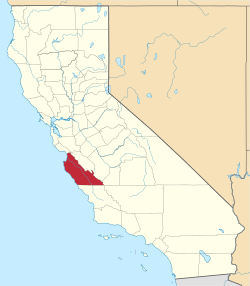
 Läge i delstaten Kalifornien. | |
Delstatens läge i USA. | |
Monterey County är ett county i delstaten Kalifornien, USA. Den administrativa huvudorten (county seat) är Salinas.
Del av Pinnacles nationalmonument ligger i countyt.
Geografi
Enligt United States Census Bureau så har countyt en total yta på 9 767 km². Av den arean utgörs 8 604 km² av land, och resterande 1 163 km² av vatten.
Angränsande countyn
- San Luis Obispo County, Kalifornien - syd
- Kings County, Kalifornien - sydost
- Fresno County, Kalifornien - sydost
- San Benito County, Kalifornien - öst
- Santa Cruz County, Kalifornien - nord
Se även

| ||||||||||
Källor
- ^ ”2010 Census U.S. Gazetteer Files for Counties”. U.S. Census Bureau. Arkiverad från originalet den 5 juli 2012. https://www.webcitation.org/68vYLbou5?url=http://www.census.gov/geo/www/gazetteer/files/Gaz_counties_national.txt. Läst 5 juli 2012.
- ^ ”State & County QuickFacts, Monterey County, Kalifornien” (på engelska). U.S. Census Bureau. Arkiverad från originalet den 15 juli 2011. https://www.webcitation.org/60BdNBExY?url=http://quickfacts.census.gov/qfd/states/06/06053.html. Läst 6 juli 2011.
|
Media som används på denna webbplats
Flag of California. This version is designed to accurately depict the standard print of the bear as well as adhere to the official flag code regarding the size, position and proportion of the bear, the colors of the flag, and the position and size of the star.
Författare/Upphovsman: Huebi, Licens: CC BY 2.0
Map of USA with California highlighted
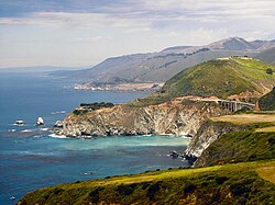
A view of the Big Sur coast including the Bixby bridge


