Moḩammadābād (ort i Kurdistan, lat 35,08, long 47,18)
| Den här artikeln har skapats av Lsjbot, ett program (en robot) för automatisk redigering. (2016-09) Artikeln kan innehålla fakta- eller språkfel, eller ett märkligt urval av fakta, källor eller bilder. Mallen kan avlägsnas efter en kontroll av innehållet (vidare information) |
| Moḩammadābād (مُحَمَّدابادِ كَريان) | |
| Kīriyān, Muhammadābād, Moḩammadābād-e Kareyān, مُحَمَّدابادِ كَرِيان, محمد آباد, Moḩammadābād-e Karīān | |
| Ort | |
| Land | |
|---|---|
| Provins | Kurdistan |
| Höjdläge | 1 726 m ö.h. |
| Koordinater | 35°04′47″N 47°10′40″Ö / 35.0796°N 47.1777°Ö |
| Folkmängd | 336från enwiki |
| Tidszon | IRST (UTC+3:30) |
| - sommartid | IRDT (UTC+4:30) |
| Geonames | 123610 |
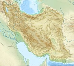
Läge i Iran | |
Moḩammadābād (persiska: مُحَمَّدابادِ كَريان, مُحَمَّدابادِ كَرِيان, محمد آباد, Moḩammadābād-e Karīān) är en ort i Iran.[1] Den ligger i provinsen Kurdistan, i den nordvästra delen av landet, 400 km väster om huvudstaden Teheran. Moḩammadābād ligger 1 726 meter över havet[1] och antalet invånare är 336.[2]
Terrängen runt Moḩammadābād är huvudsakligen kuperad, men åt nordväst är den bergig. Moḩammadābād ligger nere i en dal.[a] Den högsta punkten i närheten är Kūh-e Posht Ābādī, 2 153 meter över havet, 2,5 km norr om Moḩammadābād.[b] Runt Moḩammadābād är det ganska tätbefolkat, med 65 invånare per kvadratkilometer.[4] Närmaste större samhälle är Mūchesh, 3,6 km sydväst om Moḩammadābād. Trakten runt Moḩammadābād består i huvudsak av gräsmarker.[5]
Kommentarer
Källor
- ^ [a b c] Moḩammadābād hos Geonames.org (cc-by); post uppdaterad 2012-01-16; databasdump nerladdad 2016-08-15
- ^ (uppgift tagen från enwiki 2015-07-18)
- ^ ”Viewfinder Panoramas Digital elevation Model”. http://www.viewfinderpanoramas.org/dem3.html. Läst 21 juni 2015.
- ^ ”NASA Earth Observations: Population Density”. NASA/SEDAC. Arkiverad från originalet den 9 februari 2016. https://web.archive.org/web/20160209064446/http://neo.sci.gsfc.nasa.gov/view.php?datasetId=SEDAC_POP. Läst 30 januari 2016.
- ^ ”NASA Earth Observations: Land Cover Classification”. NASA/MODIS. Arkiverad från originalet den 28 februari 2016. https://web.archive.org/web/20160228161657/http://neo.sci.gsfc.nasa.gov/view.php?datasetId=MCD12C1_T1. Läst 30 januari 2016.
Media som används på denna webbplats
Robot icon
Flag of Iran. The tricolor flag was introduced in 1906, but after the Islamic Revolution of 1979 the Arabic words 'Allahu akbar' ('God is great'), written in the Kufic script of the Qur'an and repeated 22 times, were added to the red and green strips where they border the white central strip and in the middle is the emblem of Iran (which is a stylized Persian alphabet of the Arabic word Allah ("God")).
The official ISIRI standard (translation at FotW) gives two slightly different methods of construction for the flag: a compass-and-straightedge construction used for File:Flag of Iran (official).svg, and a "simplified" construction sheet with rational numbers used for this file.
Författare/Upphovsman: Uwe Dedering, Licens: CC BY-SA 3.0
Topographic map of the Iranian plateau in Central Asia, connecting to Anatolia in the west and Hindu Kush and Himalaya in the east.
Shiny red button/marker widget. Used to mark the location of something such as a tourist attraction.


