Milford, Delaware
| Milford | |
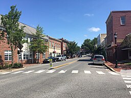
Walnut Street | |
| Land | |
|---|---|
| Delstat | Delaware |
| County | Kent County, Sussex County |
| Koordinater | 38°54′35″N 75°25′23″V / 38.90972°N 75.42306°V |
| Yta | 24,7 km² (2010)[1] |
| - land | 24,5 km² |
| - vatten | 0,2 km² |
| Folkmängd | 9 559 (2010) |
| Befolkningstäthet | 390 invånare/km² |
| Tidszon | EST (UTC-5) |
| - sommartid | EDT (UTC-4) |
| ZIP-kod | 19960, 19963[2] |
| FIPS | 1047420 |
| Geonames | 4143658 |
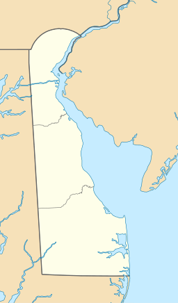
Ortens läge i Delaware | |
Delawares läge i USA | |
Milford, stad dels i Kent County, dels i Sussex County i Delaware i USA med 9 559 invånare (2010). Den har enligt United States Census Bureau en area på 14,5 km².
Källor
- ^ ”2010 Census Gazetteer Files”. US Census Bureau. Arkiverad från originalet den 14 juli 2012. https://www.webcitation.org/699nOulzi?url=http://www.census.gov/geo/www/gazetteer/files/Gaz_places_national.txt. Läst 14 juli 2012.
- ^ ”2010 ZIP Code Tabulation Area (ZCTA) Relationship Files”. U.S. Census Bureau. 30 augusti 2010. Arkiverad från originalet den 25 augusti 2012. https://www.webcitation.org/6ABdwXxbq?url=http://www.census.gov/geo/www/2010census/zcta_rel/zcta_place_rel_10.txt. Läst 25 augusti 2012.
| ||||||||||
|
Media som används på denna webbplats
Shiny red button/marker widget. Used to mark the location of something such as a tourist attraction.
Författare/Upphovsman: Huebi, Licens: CC BY 2.0
Map of USA with Delaware highlighted
Författare/Upphovsman: Alexrk2, Licens: CC BY 3.0
Den här Det karta skapades med GeoTools.
Författare/Upphovsman: Dough4872, Licens: CC BY-SA 4.0
Northbound Walnut Street at the intersection with Park Avenue in Milford, Delaware


