Midsund
| Midsund | |
| Ort | |
| Land | |
|---|---|
| Fylke | Møre og Romsdal fylke |
| Kommun | Molde kommun |
| Höjdläge | 4 m ö.h. |
| Koordinater | 62°40′25″N 6°40′26″Ö / 62.67361°N 6.67389°Ö |
| Area | 0,7 km² |
| - kommun | 86 km² |
| Folkmängd | 583 (2019)[1] |
| Befolkningstäthet | 830 inv./km² |
| Tidszon | CET (UTC+1) |
| - sommartid | CEST (UTC+2) |
| Tätortskod | 6211 |
| Geonames | 3145922 |
(c) Karte: NordNordWest, Lizenz: Creative Commons by-sa-3.0 de Ortens läge i Møre og Romsdal fylke | |
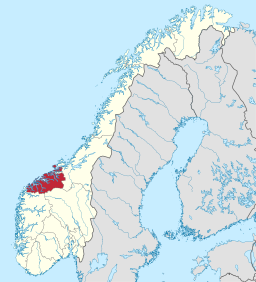
(c) Karte: NordNordWest, Lizenz: Creative Commons by-sa-3.0 de Møre og Romsdal fylke i Norge | |
| Wikimedia Commons: Midsund | |
Redigera Wikidata | |
Midsund är en tätort i Molde kommun i Møre og Romsdal fylke i västra Norge. Orten ligger vid fylkesväg 668 på ön Otrøya och har tidigare utgjort centralort i de dåvarande kommunerna Sør-Aukra respektive Midsund.
Referenser
- ^ Tettsteders befolkning og areal (på norskt bokmål), Statistisk sentralbyrå, läs online.[källa från Wikidata]
Media som används på denna webbplats
Författare/Upphovsman: Gutten på Hemsen, Licens: CC0
Flag of Norway with colors from the previous version on Commons. This file is used to discuss the colors of the Norwegian flag.
(c) Karte: NordNordWest, Lizenz: Creative Commons by-sa-3.0 de
Location map of Møre og Romsdal, Norway
Shiny red button/marker widget. Used to mark the location of something such as a tourist attraction.
(c) Karte: NordNordWest, Lizenz: Creative Commons by-sa-3.0 de
Location of county Møre og Romsdal in Norway (2024)
The village of Midsund, (Møre og Romsdal province, Norway) seen from the opposite shore of the small strait that separates the islands Otrøy (far side) and Midøy. A bridge connects the two islands. To the right the small strait connects with the larger Moldefjord.


